IMAGES TAKEN NEAR TO
Pomeroy Avenue, ME8 7FN
Introduction
This page details the photographs taken nearby to Pomeroy Avenue, ME8 7FN by members of the Geograph project.
The Geograph project started in 2005 with the aim of publishing, organising and preserving representative images for every square kilometre of Great Britain, Ireland and the Isle of Man.

There are currently over 7.5m images from over14,400 individuals and you can help contribute to the project by visiting https://www.geograph.org.uk
Image Map
Images are licensed for reuse under creativecommons.org/licenses/by-sa/2.0
Notes
- Clicking on the map will re-center to the selected point.
- The higher the marker number, the further away the image location is from the centre of the postcode.
Image Listing (49 Images Found)
Images are licensed for reuse under creativecommons.org/licenses/by-sa/2.0
Image
Details
Distance
1
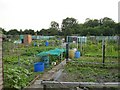
Allotments at Berengrave
South of the Lower Road, next to Berengrave nature reserve.
Image: © Penny Mayes
Taken: 16 Jun 2006
0.05 miles
2
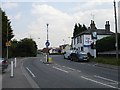
The Angel, Lower Rainham
The pub stands on the junction of Station Road with Lower Rainham Road, a junction now regulated by the ubiquitous mini-roundabout. The flag of St George is on display because of the football World Cup.
Image: © Penny Mayes
Taken: 16 Jun 2006
0.09 miles
3
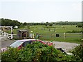
Horsiculture in Lower Rainham
Not so long ago the marginal land north of the Lower Road was dotted with paddocks with tumble-down home-made shacks to house the feed and tack. Things are more formalised now with brick-built stables and fancy fencing but the basic activity is the same. Unfortunately the road is often much busier now.
Image: © Penny Mayes
Taken: 16 Jun 2006
0.10 miles
4
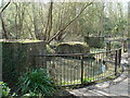
Remains of Wash Mills in Berengrave Nature Reserve
These were used (1912-1920) to grind chalk to a slurry, which was then pumped to the British Standard cement plant at Motney Hill (see Image). The washmills were abandoned when the plant was uprated after World War I, and instead raw chalk was taken by 2 ft gauge railway (see Image) to the plant, where new, larger washmills were installed.
Image: © Phil Bull
Taken: 31 Mar 2009
0.10 miles
5
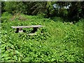
Picnic area, Berengrave nature reserve
Somewhat overgrown with bindweed and nettles. You can just make out the rails of the fence around it, completely covered in bindweed.
Image: © Penny Mayes
Taken: 16 Jun 2006
0.11 miles
6
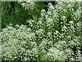
Pepperwort (Lepidium campestre)
On Berengrave nature reserve. This part of the nature reserve to the north of the Lower Road looks like a brown-field site with evidence of long-gone buildings, I think there used to be a brick works here.
Image: © Penny Mayes
Taken: 16 Jun 2006
0.11 miles
8
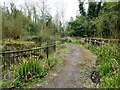
Berengrave Local Nature Reserve, Rainham
This part of the reserve is an industrial archaeology site, with the excavated remains of buildings and a pair of washmills. The wooded reserve is an old chalk pit which provided chalk for cement production between 1901 and 1931. The washmills were the first stage in the processing of chalk before it was used for making cement.
Image: © pam fray
Taken: 5 Apr 2022
0.12 miles