IMAGES TAKEN NEAR TO
Pump Lane, GILLINGHAM, ME8 7AD
Introduction
This page details the photographs taken nearby to Pump Lane, ME8 7AD by members of the Geograph project.
The Geograph project started in 2005 with the aim of publishing, organising and preserving representative images for every square kilometre of Great Britain, Ireland and the Isle of Man.

There are currently over 7.5m images from over14,400 individuals and you can help contribute to the project by visiting https://www.geograph.org.uk
Image Map
Images are licensed for reuse under creativecommons.org/licenses/by-sa/2.0
Notes
- Clicking on the map will re-center to the selected point.
- The higher the marker number, the further away the image location is from the centre of the postcode.
Image Listing (50 Images Found)
Images are licensed for reuse under creativecommons.org/licenses/by-sa/2.0
Image
Details
Distance
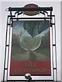
3
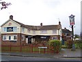
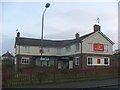
The Dewdrop Public House, Twydall
On junction of Begonia Avenue and Hawthorne Avenue.
Image: © David Anstiss
Taken: 8 Nov 2008
0.06 miles
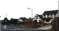
9
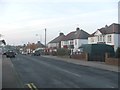
Medway - Rainham Mark
This view shows an area of houses in the centre of the Medway conurbation.
Image: © David Rayner
Taken: 17 May 2005
0.10 miles
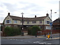
10

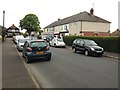
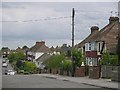
Pump Lane, Twydall
Tuesday is bins day, plus either recycling or garden waste pick up day on alternate weeks. This week it is time to pick up the blue recycling bags.
Image: © Danny P Robinson
Taken: 15 Jul 2008
0.12 miles