IMAGES TAKEN NEAR TO
Hartley Mews, GILLINGHAM, ME8 6EA
Introduction
This page details the photographs taken nearby to Hartley Mews, ME8 6EA by members of the Geograph project.
The Geograph project started in 2005 with the aim of publishing, organising and preserving representative images for every square kilometre of Great Britain, Ireland and the Isle of Man.

There are currently over 7.5m images from over14,400 individuals and you can help contribute to the project by visiting https://www.geograph.org.uk
Image Map
Images are licensed for reuse under creativecommons.org/licenses/by-sa/2.0
Notes
- Clicking on the map will re-center to the selected point.
- The higher the marker number, the further away the image location is from the centre of the postcode.
Image Listing (70 Images Found)
Images are licensed for reuse under creativecommons.org/licenses/by-sa/2.0
Image
Details
Distance
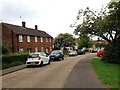
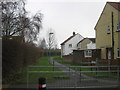
6
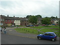
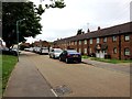
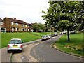
Houses on Hawkhurst Road, Twydall
At the junction with Eastcourt Lane.
Image: © Danny P Robinson
Taken: 15 Jul 2008
0.11 miles
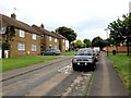
7
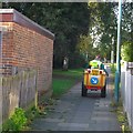
Weed Sprayer, Twydall
This mini-tractor and driver was on a path between Hawkhurst Road and Allington Road.
Several contractors were going around the town with large drums of weed spray.
Image: © David Anstiss
Taken: 10 Oct 2012
0.11 miles
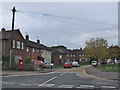
8
Lenham Way
This walkway leads from Hawkhurst Road to Allington Road.
Like a lot of roads in Twydall, the name refers to places in Kent.
Image: © David Anstiss
Taken: 20 Jan 2011
0.12 miles