
IMAGES TAKEN NEAR TO
Hotel Road, GILLINGHAM, ME8 6AF
Introduction
This page details the photographs taken nearby to Hotel Road, ME8 6AF by members of the Geograph project.
The Geograph project started in 2005 with the aim of publishing, organising and preserving representative images for every square kilometre of Great Britain, Ireland and the Isle of Man.

There are currently over 7.5m images from over14,400 individuals and you can help contribute to the project by visiting https://www.geograph.org.uk
Image Map
Images are licensed for reuse under creativecommons.org/licenses/by-sa/2.0
Notes
- Clicking on the map will re-center to the selected point.
- The higher the marker number, the further away the image location is from the centre of the postcode.
Image Listing (48 Images Found)
Images are licensed for reuse under creativecommons.org/licenses/by-sa/2.0
Image
Details
Distance
1
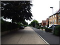
Hotel Road, Gillingham
This road running parallel to Sovereign Boulevard was relatively recently named as "Hotel Road", after the 1930s built Central Hotel which used to be located here. The hotel was demolished and was replaced by the housing development on the right.
Image: © Chris Whippet
Taken: 16 Aug 2010
0.01 miles
2

Hotel Road, Twydall
Seen from Featherby Road. This road just leads to Danecourt School and housing along the road. The other side of the trees on the left is the A2 Watling Street dual carriageway.
Image: © David Anstiss
Taken: 24 Sep 2009
0.01 miles
3

Hotel Road, Twydall
Formerly the site of the old Central Hotel.
Image: © Chris Whippet
Taken: 20 Nov 2014
0.02 miles

5
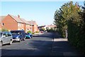
Featherby Road, Twydall
This road leads from the A2 Watling Street dual carriageway, towards Beechings Way.
Image: © David Anstiss
Taken: 24 Sep 2009
0.04 miles


8

Roko Health Club
On A2 towards Chatham.
Image: © David Anstiss
Taken: 16 Oct 2008
0.06 miles

10
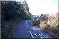
Footpath and cyclepath to B and Q Store
This path lead of the A2 Watling Street dual carriageway. Store is on the right.
Image: © David Anstiss
Taken: 24 Sep 2009
0.09 miles