IMAGES TAKEN NEAR TO
Woodlands Road, GILLINGHAM, ME7 2DX
Introduction
This page details the photographs taken nearby to Woodlands Road, ME7 2DX by members of the Geograph project.
The Geograph project started in 2005 with the aim of publishing, organising and preserving representative images for every square kilometre of Great Britain, Ireland and the Isle of Man.

There are currently over 7.5m images from over14,400 individuals and you can help contribute to the project by visiting https://www.geograph.org.uk
Image Map
Images are licensed for reuse under creativecommons.org/licenses/by-sa/2.0
Notes
- Clicking on the map will re-center to the selected point.
- The higher the marker number, the further away the image location is from the centre of the postcode.
Image Listing (56 Images Found)
Images are licensed for reuse under creativecommons.org/licenses/by-sa/2.0
Image
Details
Distance
1

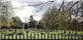
Woodlands Cemetery Entrance, Gillingham
The Chapel of Rest seen in background.
Very Large Cemetery approx. 2 1/2 acres.
Image: © David Anstiss
Taken: 16 Oct 2008
0.03 miles
2

Railway Bridge over Woodlands Road
Road goes through bridge to the A289, from the A2.
Image: © David Anstiss
Taken: 16 Oct 2008
0.03 miles
3
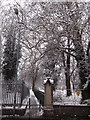
Footpath beside railway line to Cornwallis Avenue Field
This path leads from Woodlands Road. On the left is the railway line, and on the right is a large cemetery.
The path leads to a large football field.
Image: © David Anstiss
Taken: 5 Feb 2012
0.03 miles
4
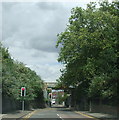
Railway bridge over Woodlands Road, Gillingham
Image: © Chris Whippet
Taken: 22 Jul 2010
0.04 miles
5

Lodge in Woodlands Cemetery
Used as a daily office, by cemetery staff and grounds keepers.
Image: © David Anstiss
Taken: 16 Oct 2008
0.05 miles
6

Woodlands Road Allotments
As seen from the access road, from Tangmere Close.
Image: © David Anstiss
Taken: 4 Dec 2011
0.08 miles
7
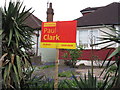
Election poster on Woodlands Road
Paul Clark is running against the current incumbent Tory Rehman Chistie.
There has not been many election posters in the gardens of Gillingham residents.
Image: © David Anstiss
Taken: 25 Apr 2015
0.08 miles
9
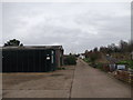
Track into Woodlands Road Allotments
This access track leads from Tangmere Close into the large L-shaped allotments.
The sheds in the foreground contain chippings and compost to be used by the allotment holders.
Image: © David Anstiss
Taken: 4 Dec 2011
0.10 miles