IMAGES TAKEN NEAR TO
Malling Road, SNODLAND, ME6 5QB
Introduction
This page details the photographs taken nearby to Malling Road, ME6 5QB by members of the Geograph project.
The Geograph project started in 2005 with the aim of publishing, organising and preserving representative images for every square kilometre of Great Britain, Ireland and the Isle of Man.

There are currently over 7.5m images from over14,400 individuals and you can help contribute to the project by visiting https://www.geograph.org.uk
Image Map
Images are licensed for reuse under creativecommons.org/licenses/by-sa/2.0
Notes
- Clicking on the map will re-center to the selected point.
- The higher the marker number, the further away the image location is from the centre of the postcode.
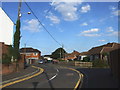
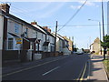
Image Listing (58 Images Found)
Images are licensed for reuse under creativecommons.org/licenses/by-sa/2.0
Image
Details
Distance
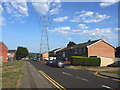
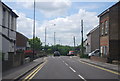
2
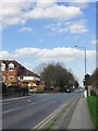
Malling Road, Ham Hill
Looking NNE, towards Snodland.
Image: © Stefan Czapski
Taken: 15 Mar 2017
0.05 miles
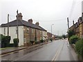
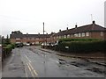
4
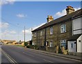
Clifton Terrace, Malling Road, Ham Hill
Fairly typical of older dwellings around here, and dated 1891 (according to a painted inscription at the far end). Snodland was originally a quarrying village, so this terrace may well have been built by a quarry company for the accommodation of its workers.
Image: © Stefan Czapski
Taken: 15 Mar 2017
0.06 miles