IMAGES TAKEN NEAR TO
Ashbee Close, SNODLAND, ME6 5HQ
Introduction
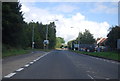
This page details the photographs taken nearby to Ashbee Close, ME6 5HQ by members of the Geograph project.
The Geograph project started in 2005 with the aim of publishing, organising and preserving representative images for every square kilometre of Great Britain, Ireland and the Isle of Man.

There are currently over 7.5m images from over14,400 individuals and you can help contribute to the project by visiting https://www.geograph.org.uk
Image Map
Images are licensed for reuse under creativecommons.org/licenses/by-sa/2.0
Notes
- Clicking on the map will re-center to the selected point.
- The higher the marker number, the further away the image location is from the centre of the postcode.
Image Listing (41 Images Found)
Images are licensed for reuse under creativecommons.org/licenses/by-sa/2.0
Image
Details
Distance
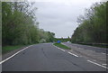
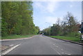
5
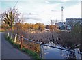
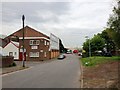
Drainage channel, Snodland
To the left is the access to the Brookland Lake car park. The lake was once a gravel pit, but is now a fishing lake. To the right are industrial buildings close to the A228, Snodland bypass.
Image: © Richard Dorrell
Taken: 12 Mar 2008
0.16 miles