IMAGES TAKEN NEAR TO
Saracen Fields, CHATHAM, ME5 9DG
Introduction
This page details the photographs taken nearby to Saracen Fields, ME5 9DG by members of the Geograph project.
The Geograph project started in 2005 with the aim of publishing, organising and preserving representative images for every square kilometre of Great Britain, Ireland and the Isle of Man.

There are currently over 7.5m images from over14,400 individuals and you can help contribute to the project by visiting https://www.geograph.org.uk
Image Map
Images are licensed for reuse under creativecommons.org/licenses/by-sa/2.0
Notes
- Clicking on the map will re-center to the selected point.
- The higher the marker number, the further away the image location is from the centre of the postcode.
Image Listing (13 Images Found)
Images are licensed for reuse under creativecommons.org/licenses/by-sa/2.0
Image
Details
Distance
3
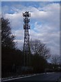
Mobile Phone Tower on Lords Wood Lane
This mast is used by O2 and Orange Networks.
Image: © David Anstiss
Taken: 5 Jan 2010
0.13 miles
4
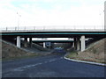
Formerly Lordswood Lane
By-passed in the early 1980s so as to meet the roundabout with Walderslade Woods Road, Boxley Road, Harp Farm Road and Westfield Sole Road.
Image: © Chris Whippet
Taken: 17 Dec 2008
0.16 miles
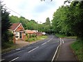
5
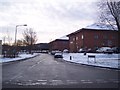
Revenge Road
Leads from Badger Road to Gleaming Wood Road. Many small businesses are sited along this road.
Image: © David Anstiss
Taken: 5 Jan 2010
0.19 miles
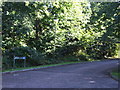
7
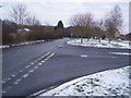
Road junction on Lords Wood Lane
Lords Wood Lane leads straight on towards North Dane Way towards Chatham. Badger Road leads left towards Gleaming Wood Drive. Also Tuscan Court is seen on the left.
Image: © David Anstiss
Taken: 5 Jan 2010
0.20 miles
8
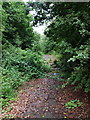
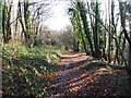
The old route of Westfield Sole Road
By-passed in the early 1980s following the construction of Walderslade Woods Road and the Westfield Sole roundabout.
Image: © Chris Whippet
Taken: 27 Aug 2010
0.20 miles
9
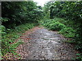
The old route of Westfield Sole Road
This stretch of Westfield Sole Road used to lead to a T-junction with Boxley Road and Harp Farm Road before being by-passed after the construction of the roundabout around 1984.
Image: © Chris Whippet
Taken: 27 Aug 2010
0.21 miles