IMAGES TAKEN NEAR TO
Chestnut Avenue, CHATHAM, ME5 9BF
Introduction
This page details the photographs taken nearby to Chestnut Avenue, ME5 9BF by members of the Geograph project.
The Geograph project started in 2005 with the aim of publishing, organising and preserving representative images for every square kilometre of Great Britain, Ireland and the Isle of Man.

There are currently over 7.5m images from over14,400 individuals and you can help contribute to the project by visiting https://www.geograph.org.uk
Image Map
Images are licensed for reuse under creativecommons.org/licenses/by-sa/2.0
Notes
- Clicking on the map will re-center to the selected point.
- The higher the marker number, the further away the image location is from the centre of the postcode.
Image Listing (39 Images Found)
Images are licensed for reuse under creativecommons.org/licenses/by-sa/2.0
Image
Details
Distance
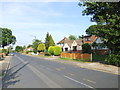
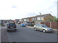
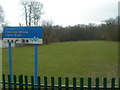
1
Chestnut Avenue Open Space
As seen from Chestnut Avenue, opposite Repton Way.
A footpath leads through the woodland towards Walderslade.
Image: © David Anstiss
Taken: 9 Jul 2015
0.04 miles
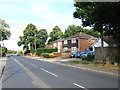
2
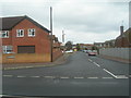
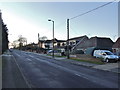
Repton Way, Walderslade
Junction of Chestnut Avenue
Image: © Danny P Robinson
Taken: 24 Mar 2006
0.05 miles
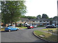
3
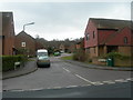
Bulrush Close, Walderslade
Taken at junction of Chestnut Avenue
Image: © Danny P Robinson
Taken: 24 Mar 2006
0.05 miles
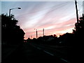
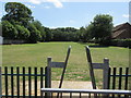
7
Chestnut Avenue Open Space
Taken near junction with Repton Way.
Image: © Danny P Robinson
Taken: 24 Mar 2006
0.07 miles