IMAGES TAKEN NEAR TO
Holder Close, CHATHAM, ME5 8LW
Introduction
This page details the photographs taken nearby to Holder Close, ME5 8LW by members of the Geograph project.
The Geograph project started in 2005 with the aim of publishing, organising and preserving representative images for every square kilometre of Great Britain, Ireland and the Isle of Man.

There are currently over 7.5m images from over14,400 individuals and you can help contribute to the project by visiting https://www.geograph.org.uk
Image Map
Images are licensed for reuse under creativecommons.org/licenses/by-sa/2.0
Notes
- Clicking on the map will re-center to the selected point.
- The higher the marker number, the further away the image location is from the centre of the postcode.
Image Listing (44 Images Found)
Images are licensed for reuse under creativecommons.org/licenses/by-sa/2.0
Image
Details
Distance

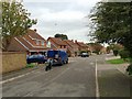

5
Footpath crosses North Dane Way
A footpath from Shawstead Road (near Capstone Farm Country Park) crosses the road towards a cyclepath following the road (left to Lords Wood, or right to Luton). Also the footpath carries on towards Scarlett Close.
Image: © David Anstiss
Taken: 24 Feb 2011
0.06 miles