IMAGES TAKEN NEAR TO
Birkhall Close, CHATHAM, ME5 7QD
Introduction
This page details the photographs taken nearby to Birkhall Close, ME5 7QD by members of the Geograph project.
The Geograph project started in 2005 with the aim of publishing, organising and preserving representative images for every square kilometre of Great Britain, Ireland and the Isle of Man.

There are currently over 7.5m images from over14,400 individuals and you can help contribute to the project by visiting https://www.geograph.org.uk
Image Map (Loading...)


Getting Data...Please wait
Leaflet Map data © OpenStreetMap
Images are licensed for reuse under creativecommons.org/licenses/by-sa/2.0
Notes
- Clicking on the map will re-center to the selected point.
- The higher the marker number, the further away the image location is from the centre of the postcode.
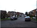
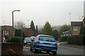
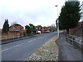
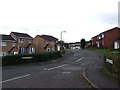
Image Listing (41 Images Found)
Images are licensed for reuse under creativecommons.org/licenses/by-sa/2.0
Image
Details
Distance
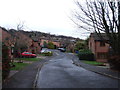
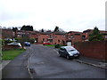
4

Hampton Close, Walderslade
Taken from Highgrove Road. House in the background are on Swallow Rise.
Image: © Danny P Robinson
Taken: 24 Mar 2006
0.06 miles
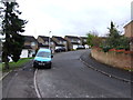
7
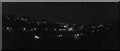
Walderslade valley
It is the light swerving through the valley that make it a great picture because it is inside the valley and the total effect of the lights in the valley following off into the distance.
Image: © Aidan Wolfe
Taken: 11 Dec 2011
0.08 miles