IMAGES TAKEN NEAR TO
Charlotte Close, CHATHAM, ME5 7LQ
Introduction
This page details the photographs taken nearby to Charlotte Close, ME5 7LQ by members of the Geograph project.
The Geograph project started in 2005 with the aim of publishing, organising and preserving representative images for every square kilometre of Great Britain, Ireland and the Isle of Man.

There are currently over 7.5m images from over14,400 individuals and you can help contribute to the project by visiting https://www.geograph.org.uk
Image Map
Images are licensed for reuse under creativecommons.org/licenses/by-sa/2.0
Notes
- Clicking on the map will re-center to the selected point.
- The higher the marker number, the further away the image location is from the centre of the postcode.
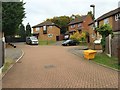
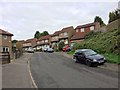
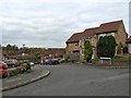
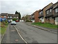
Image Listing (49 Images Found)
Images are licensed for reuse under creativecommons.org/licenses/by-sa/2.0
Image
Details
Distance
4
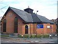
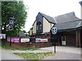
Church of Christ the King, Princes Park
Church of England.
Image: © Robin Webster
Taken: 25 Jun 2012
0.07 miles
5
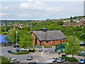
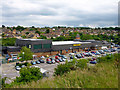
Christ the King Church, Princes Park
Back view of church, from Morrison's supermarket carpark.
On junction of Dove Close and Princess Avenue.
Image: © David Anstiss
Taken: 7 Nov 2008
0.07 miles
6
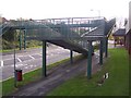
Footbridge over Princess Avenue
Morrison's supermarket on right of photo.
Various houses in Princes Park on left.
Image: © David Anstiss
Taken: 7 Nov 2008
0.08 miles
8
Morrisons, Princes Park
Princes Avenue is on the other side of the supermarket.
Image: © Robin Webster
Taken: 25 Jun 2012
0.09 miles