IMAGES TAKEN NEAR TO
Beacon Road, CHATHAM, ME5 7BY
Introduction
This page details the photographs taken nearby to Beacon Road, ME5 7BY by members of the Geograph project.
The Geograph project started in 2005 with the aim of publishing, organising and preserving representative images for every square kilometre of Great Britain, Ireland and the Isle of Man.

There are currently over 7.5m images from over14,400 individuals and you can help contribute to the project by visiting https://www.geograph.org.uk
Image Map
Images are licensed for reuse under creativecommons.org/licenses/by-sa/2.0
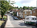
Notes
- Clicking on the map will re-center to the selected point.
- The higher the marker number, the further away the image location is from the centre of the postcode.
Image Listing (81 Images Found)
Images are licensed for reuse under creativecommons.org/licenses/by-sa/2.0
Image
Details
Distance
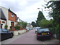
1
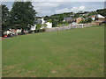
Queens Road playing field
Queens Road is on the left.
Image: © David Anstiss
Taken: 26 Aug 2009
0.04 miles
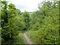
2
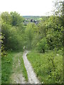
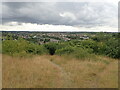
Path towards Beacon Road
A path leads steeply down from Ash Tree Lane.
In the background is Wayfield on the other side of the Capstone Valley.
Image: © David Anstiss
Taken: 8 May 2013
0.04 miles
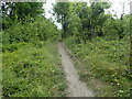
3
Path down from Darland Banks
This steep path leads down from Ash Three Lane to Beacon Road.
Darland Banks on the southern edge of Gillingham is a fine chalk grassland, interspersed with scrub and secondary woodland. The population of man orchids is one of the largest in the United Kingdom. The area has been accessible for more than a hundred years and the grassland slopes were historically used as common land for the grazing of cattle and sheep.
Image: © Marathon
Taken: 27 Jul 2022
0.04 miles
4
Path up to Darland Banks
This steep path leads up from Beacon Road to Ash Three Lane.
Darland Banks on the southern edge of Gillingham is a fine chalk grassland, interspersed with scrub and secondary woodland. The population of man orchids is one of the largest in the United Kingdom. The area has been accessible for more than a hundred years and the grassland slopes were historically used as common land for the grazing of cattle and sheep.
Image: © Marathon
Taken: 27 Jul 2022
0.06 miles
7
Darland Banks
Darland Banks on the southern edge of Gillingham is a fine chalk grassland, interspersed with scrub and secondary woodland. The population of man orchids is one of the largest in the United Kingdom. The area has been accessible for more than a hundred years and the grassland slopes were historically used as common land for the grazing of cattle and sheep. The information board can be seen at https://www.geograph.org.uk/photo/7239164
This view is at the top of the climb up from Ash Tree Lane as Kingsway is reached.
Image: © Marathon
Taken: 27 Jul 2022
0.09 miles
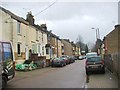
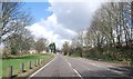
8
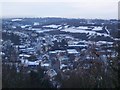
View of Street End Road, Luton, Winter 2009
Seen from near to Ash Tree Lane.
Image: © David Anstiss
Taken: 24 Dec 2009
0.09 miles