IMAGES TAKEN NEAR TO
Chatham Hill, CHATHAM, ME5 7AP
Introduction
This page details the photographs taken nearby to Chatham Hill, ME5 7AP by members of the Geograph project.
The Geograph project started in 2005 with the aim of publishing, organising and preserving representative images for every square kilometre of Great Britain, Ireland and the Isle of Man.

There are currently over 7.5m images from over14,400 individuals and you can help contribute to the project by visiting https://www.geograph.org.uk
Image Map
Images are licensed for reuse under creativecommons.org/licenses/by-sa/2.0
Notes
- Clicking on the map will re-center to the selected point.
- The higher the marker number, the further away the image location is from the centre of the postcode.
Image Listing (156 Images Found)
Images are licensed for reuse under creativecommons.org/licenses/by-sa/2.0
Image
Details
Distance
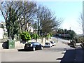
1
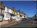
Wall writing, A2 Chatham Hill
'F. Thomas Mill Farm House - Farm - Old Raspberry Park Iwade Sittingbourne'. A slightly odd message, but what has latterly been mapped as 'Mill House' lies above the retaining wall. There is an interesting story about Thomas, who indeed lived in Mill House. In the late 1950s he applied for planning permission for a house on a site off Twydall Lane, Gillingham, and was refused. He used this wall to post his views about this while he fought the matter. He still lost, so he built a barn on the site, which did not need planning permission, that looked exactly like a house, but wasn't. This is now gone, the site has a Mormon church. I wonder if there is any record of what he wrote on this wall?
Image: © Robin Webster
Taken: 25 Jun 2012
0.02 miles
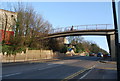
2
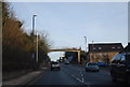
Footbridge over A2 London Road
Bridge leads from Windmill Road to Grange Hill or Upper Luton Road. A2 leads right into Chatham from Gillingham.
Image: © David Anstiss
Taken: 22 Jan 2009
0.02 miles
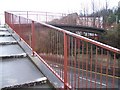
4
Pedestrian Bridge over the A2, Chatham Hill
Image: © N Chadwick
Taken: 31 Jan 2009
0.02 miles
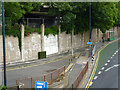
7
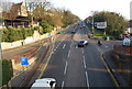
A2, Chatham Hill looking SE to junction with Upper Luton Rd
Image: © N Chadwick
Taken: 31 Jan 2009
0.03 miles
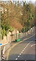
8
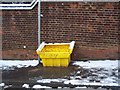
Empty Salt Bin on Windmill Road
These yellow bin should contain rock salt or grit. But due to the recent heavy snowfall. Empty !!
Image: © David Anstiss
Taken: 7 Jan 2010
0.03 miles