IMAGES TAKEN NEAR TO
Quayside, Chatham Maritime, CHATHAM, ME4 4QU
Introduction
This page details the photographs taken nearby to Quayside, Chatham Maritime, ME4 4QU by members of the Geograph project.
The Geograph project started in 2005 with the aim of publishing, organising and preserving representative images for every square kilometre of Great Britain, Ireland and the Isle of Man.

There are currently over 7.5m images from over14,400 individuals and you can help contribute to the project by visiting https://www.geograph.org.uk
Image Map
Images are licensed for reuse under creativecommons.org/licenses/by-sa/2.0
Notes
- Clicking on the map will re-center to the selected point.
- The higher the marker number, the further away the image location is from the centre of the postcode.
Image Listing (207 Images Found)
Images are licensed for reuse under creativecommons.org/licenses/by-sa/2.0
Image
Details
Distance
1
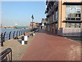
Walkway Beside Number 2 Basin, Chatham Maritime
This former dock is now mainly used for recreational purposes, for instance watersports tuition. The buildings overlooking it are offices.
Image: © Danny P Robinson
Taken: 10 Jun 2008
0.01 miles
2
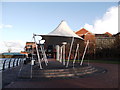
Quayside Pavilion, Chatham Maritime
This meeting place is beside Basin 3 of the former Chatham navy Docks, now re-developed.
In the background is Image, and beyond that is Image
Image: © David Anstiss
Taken: 17 Apr 2012
0.03 miles
3

Victory House, Chatham
One of the modern office blocks over looking Basin 2 of Chatham Maritime.
Image: © David Anstiss
Taken: 17 Apr 2012
0.04 miles
4
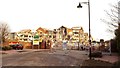
Demolition of Colonial Wharf
This large empty office building at the end of Quayside (road) was the headquarters of insurance company Colonial Mutual Life since 1994. But now Persimmon Homes has acquired the land and is demolishing the building to create dockside homes and apartments.
Image: © David Anstiss
Taken: 16 Feb 2018
0.04 miles
5
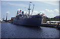
No. 2 Basin, Chatham Maritime
There is new development round the basin. The large grey vessel is Jeremiah O'Brien, a US built "Liberty Ship" that was actually present at the D-Day landings in 1944. Normally based in San Francisco, she was sailed through the Panama Canal and across the Atlantic to be the only ship that was present at the 1944 landings and the 1994 celebration of this event. A book was written about this epic voyage - Appointment in Normandy by Jaffee, WW (1995).
Image: © Chris Allen
Taken: 12 Jun 1994
0.04 miles
6
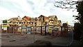
Demolition of Colonial Wharf (2)
This large empty office building at the end of Quayside (road) was the headquarters of insurance company Colonial Mutual Life since the 1994. But now Persimmon Homes has acquired the land and is demolishing the building to create dockside homes and apartments.
Image: © David Anstiss
Taken: 16 Feb 2018
0.04 miles
7
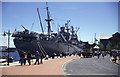
No. 2 Basin Chatham Maritime
The preserved "Liberty Ship" Jeremiah O'Brien is alongside and being visited intensively.
Image: © Chris Allen
Taken: 12 Jun 1994
0.04 miles
8
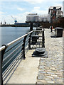
Colonial House, Quayside, Chatham Maritime
Planning permission was approved, with conditions, by Medway Council under application number MC/14/3631 for the “outline planning permission with all matters reserved for future consideration, except access, for demolition of existing buildings and structures and redevelopment for a mixed development of up to 253 apartments and houses and up to 339 sq m (3,650 sq ft) of Class A1 floor space (as defined by the Town and Country Planning (Use Classes) Order 1987 (as amended)) together with vehicular and pedestrian access, formal and informal public open space, hard and soft landscaping and associated services”.
This image of Image shows the building as it used to look before demolition started.
Image: © John Baker
Taken: 9 May 2018
0.05 miles
9
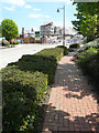
Colonial House, Quayside, Chatham Maritime
Planning permission was approved, with conditions, by Medway Council under application number MC/14/3631 for the “outline planning permission with all matters reserved for future consideration, except access, for demolition of existing buildings and structures and redevelopment for a mixed development of up to 253 apartments and houses and up to 339 sq m (3,650 sq ft) of Class A1 floorspace (as defined by the Town and Country Planning (Use Classes) Order 1987 (as amended)) together with vehicular and pedestrian access, formal and informal public open space, hard and soft landscaping and associated services”.
This image of Image shows the demolition site, when there was more of the building remaining.
Image: © John Baker
Taken: 9 May 2018
0.05 miles