
IMAGES TAKEN NEAR TO
Marine View, CHATHAM, ME4 3LA
Introduction
This page details the photographs taken nearby to Marine View, ME4 3LA by members of the Geograph project.
The Geograph project started in 2005 with the aim of publishing, organising and preserving representative images for every square kilometre of Great Britain, Ireland and the Isle of Man.

There are currently over 7.5m images from over14,400 individuals and you can help contribute to the project by visiting https://www.geograph.org.uk
Image Map
Images are licensed for reuse under creativecommons.org/licenses/by-sa/2.0
Notes
- Clicking on the map will re-center to the selected point.
- The higher the marker number, the further away the image location is from the centre of the postcode.
Image Listing (135 Images Found)
Images are licensed for reuse under creativecommons.org/licenses/by-sa/2.0
Image
Details
Distance
1
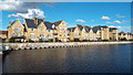
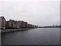
Housing on St. Mary's Island, Chatham
New housing on the quayside at one of Chatham's former docks.
Image: © Malc McDonald
Taken: 7 Sep 2013
0.01 miles
3
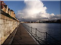
Boardwalk, Basin 2, Chatham Maritime
This floating walkway leads from Maritime Avenue (the main road leading to the island) to a pontoon walkway beside the former dock. It is part of a walkway around the island.
In the background is Chatham Docks (around Basin 3).
Image: © David Anstiss
Taken: 17 Apr 2012
0.03 miles
4
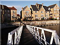
The Boardwalk, Basin 2, St Mary's Island
This floating walkway leads from Maritime Avenue (the main road leading to the island) to a pontoon walkway beside the former dock. It is part of a walkway around the island.
Image: © David Anstiss
Taken: 17 Apr 2012
0.03 miles
6
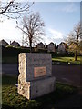
St Mary's Island Dedication Block, Chatham Maritime
This stone is beside Basin 2 of the former Chatham Navy Dockyard.
In 1984 the Dockyard closed and the site was divided into various sections. St Mary's Island was then created to be transformed into a residential community for some 1,500 homes. It has several themed areas with traditional maritime buildings, a fishing (in looks only) village with its multi-coloured houses and a modern energy-efficient concept. Many homes have views of the River Medway.
This block with a plaque (unveilled by John Prescott MP) was formed from one of the former quays on the island.
Image: © David Anstiss
Taken: 17 Apr 2012
0.05 miles
7
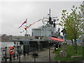
Photographing the photographer of HMS Chatham
As seen from the wharf beside Maritime Way.
This warship is in Chatham to mark the 20th anniversary of the ship's commissioning at Chatham in 1990,(outside a Naval Dockyard). It was open on Saturday and Sunday for tours around the ship. This photographer was going around taking lots of shots of the warship.
See http://news.bbc.co.uk/local/kent/hi/things_to_do/newsid_9167000/9167595.stm for more details.
See http://en.wikipedia.org/wiki/HMS_Chatham_(F87) for more details about the ship.
Image: © David Anstiss
Taken: 14 Nov 2010
0.05 miles
8
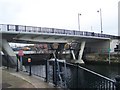
Road Bridge to St Mary's Island, Chatham
The Maritime Way road goes from St Mary's Island (on the left) towards Chatham on the right. A footpath over the locks between Basin No.1 (on right) and Basin No.2 (on the left), gives safe pedestrian access from houses to Colleges and other buildings.
Image: © David Anstiss
Taken: 7 Nov 2008
0.07 miles
9
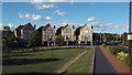
Houses, St. Mary's Island, Chatham
A crescent of recently-built houses on St. Mary's Island, Chatham.
This image was taken on a September day, in the late afternoon when shadows were lengthening. The houses face progressively more to the east, the further to the left of the image they are. Although the side of the house to the left is still sunlit, the front is now in shadow. The fronts of the other houses, which face progressively more to the south, are still in sun.
Image: © Malc McDonald
Taken: 7 Sep 2013
0.07 miles
10
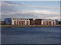
Two large apartment blocks, St Mary's Island
Looking across Basin 2, Chatham Maritime towards two large housing blocks on Restharrow Way on the island.
Image: © David Anstiss
Taken: 17 Apr 2012
0.08 miles