St Mary's Island Dedication Block, Chatham Maritime
Introduction
The photograph on this page of St Mary's Island Dedication Block, Chatham Maritime by David Anstiss as part of the Geograph project.
The Geograph project started in 2005 with the aim of publishing, organising and preserving representative images for every square kilometre of Great Britain, Ireland and the Isle of Man.

There are currently over 7.5m images from over 14,400 individuals and you can help contribute to the project by visiting https://www.geograph.org.uk
St Mary's Island Dedication Block, Chatham Maritime
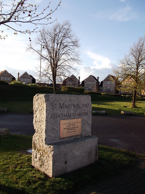
Image: © David Anstiss Taken: 17 Apr 2012
This stone is beside Basin 2 of the former Chatham Navy Dockyard. In 1984 the Dockyard closed and the site was divided into various sections. St Mary's Island was then created to be transformed into a residential community for some 1,500 homes. It has several themed areas with traditional maritime buildings, a fishing (in looks only) village with its multi-coloured houses and a modern energy-efficient concept. Many homes have views of the River Medway. This block with a plaque (unveilled by John Prescott MP) was formed from one of the former quays on the island.
Images are licensed for reuse under creativecommons.org/licenses/by-sa/2.0
Image Location
Latitude
51.404018
Longitude
0.539174