
IMAGES TAKEN NEAR TO
Kingsmead Park, ROCHESTER, ME3 9TA
Introduction
This page details the photographs taken nearby to Kingsmead Park, ME3 9TA by members of the Geograph project.
The Geograph project started in 2005 with the aim of publishing, organising and preserving representative images for every square kilometre of Great Britain, Ireland and the Isle of Man.

There are currently over 7.5m images from over14,400 individuals and you can help contribute to the project by visiting https://www.geograph.org.uk
Image Map
Images are licensed for reuse under creativecommons.org/licenses/by-sa/2.0
Notes
- Clicking on the map will re-center to the selected point.
- The higher the marker number, the further away the image location is from the centre of the postcode.
Image Listing (35 Images Found)
Images are licensed for reuse under creativecommons.org/licenses/by-sa/2.0
Image
Details
Distance
1
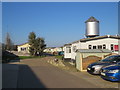
Kingsmead Park caravan park, Allhallows-on-Sea
A driveway through Kingsmead Park caravan park in Allhallows-on-Sea, in Kent.
The silver-coloured water tower is a surviving relic of a railway station which previously occupied this site. The station opened in 1932 but was closed less than 30 years later. A more detailed history of the railway station can be found on the Disused Stations website: http://www.disused-stations.org.uk/a/allhallows_on_sea/
Image: © Malc McDonald
Taken: 23 Feb 2019
0.03 miles
2
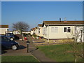
Path through Kingsmead Park caravan park, Allhallows-on-Sea
A path through Kingsmead park caravan park in Allhallows-on-Sea, in Kent.
Image: © Malc McDonald
Taken: 23 Feb 2019
0.08 miles
3
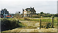
Site of Allhallows-on-Sea station, 1995
View from by the Thames Estuary shore to the British Pilot Inn in Avery Way, just beyond which had been the terminus of the ex-SR branch from Gravesend (Central) off the Port Victoria and Grain branch via Hoo Junction and Stoke Junction. The station building survived as a store for the Kingsmead Residential Caravan site, but there seems to be no trace left in 1995. The Allhallows branch was only opened in May 1932 and was closed from 4/12/61, the Railway's venture in Estate Management having failed.
Image: © Ben Brooksbank
Taken: 11 Mar 1995
0.10 miles
4
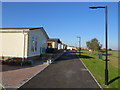
Kingsmead Park caravan park, Allhallows-on-Sea
A path at the southern end of Kingsmead Park caravan park, in Allhallows-on-Sea.
Image: © Malc McDonald
Taken: 23 Feb 2019
0.12 miles
10
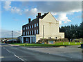
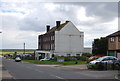
Flats, Allhallows-on-Sea
These appear to be the only substantial sign, apart from the large British Pilot pub, of the pre-war plans for a major holiday resort here. The branch railway to serve this was opened in 1932 and terminated just behind this block. It closed in 1961. The resort never developed in the way planned and has now turned itself into extensive mobile home parks, with not a great deal of conventional housing.
Image: © Robin Webster
Taken: 7 Feb 2014
0.18 miles