IMAGES TAKEN NEAR TO
Four Elms Hill, ROCHESTER, ME3 8NH
Introduction
This page details the photographs taken nearby to Four Elms Hill, ME3 8NH by members of the Geograph project.
The Geograph project started in 2005 with the aim of publishing, organising and preserving representative images for every square kilometre of Great Britain, Ireland and the Isle of Man.

There are currently over 7.5m images from over14,400 individuals and you can help contribute to the project by visiting https://www.geograph.org.uk
Image Map
Images are licensed for reuse under creativecommons.org/licenses/by-sa/2.0
Notes
- Clicking on the map will re-center to the selected point.
- The higher the marker number, the further away the image location is from the centre of the postcode.
Image Listing (34 Images Found)
Images are licensed for reuse under creativecommons.org/licenses/by-sa/2.0
Image
Details
Distance
2
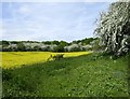
Farmland at Chattenden
Farmland north of the A228 - and south of Chattenden woods.
Photo taken in the second week of May, with the rape crop and may trees in full bloom.
Image: © Stefan Czapski
Taken: 11 May 2018
0.05 miles
4
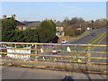
Chat up line
This bridge lies on the route of the former military railway from Lower Upnor to Chattenden Barracks http://en.wikipedia.org/wiki/Upnor#The_Military_Railway . A plaque at one end of the road says: "The Upchat Road built by Royal Engineer units under the direction of the Royal School of Military Engineering, 52 Field Squadron (Airfields) RE, Eastern Command Plant Troop RE. 1965-1967". The road has signs saying "MOD road liable to closure without notice".
The road below the bridge is Four Elms Hill, Chattenden. The piece of cloth tied to the railing says "Happy 21st ...". Clearly from the extensive collection of ties, we can tell that putting notices on the bridge is a local tradition.
Image: © Roger W Haworth
Taken: 7 Feb 2007
0.08 miles
5
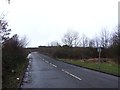
Upchat Road, near Chattenden
This road was built by the Royal Engineers in the 1960s to connect the two military camps at Upnor and Chattenden.
Image: © Chris Whippet
Taken: 5 Jan 2014
0.09 miles
8
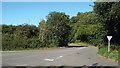
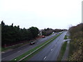
Road near Chattenden
This road is a slip road from the A228 dual-carriageway onto Upchat Road, which crosses the A228 on a bridge.
Image: © Malc McDonald
Taken: 7 Sep 2013
0.11 miles
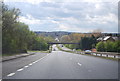
9
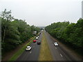
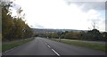
A228 towards Four Elms Roundabout
From the bridge on Upchat Road.
Image: © JThomas
Taken: 23 Jun 2022
0.12 miles
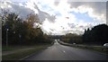
10
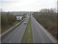
A228 Approaching Four Elms Roundabout
The A228 leads to Thamesport, a container port in the Medway Estuary.
Image: © Danny P Robinson
Taken: 24 Feb 2008
0.16 miles