IMAGES TAKEN NEAR TO
Oakleigh Grove, ROCHESTER, ME3 8GY
Introduction
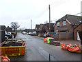
This page details the photographs taken nearby to Oakleigh Grove, ME3 8GY by members of the Geograph project.
The Geograph project started in 2005 with the aim of publishing, organising and preserving representative images for every square kilometre of Great Britain, Ireland and the Isle of Man.

There are currently over 7.5m images from over14,400 individuals and you can help contribute to the project by visiting https://www.geograph.org.uk
Image Map (18 Images)


Leaflet Map data © OpenStreetMap
Images are licensed for reuse under creativecommons.org/licenses/by-sa/2.0
Notes
- Clicking on the map will re-center to the selected point.
- The higher the marker number, the further away the image location is from the centre of the postcode.
Image Listing (18 Images Found)
Images are licensed for reuse under creativecommons.org/licenses/by-sa/2.0
Image
Details
Distance
1
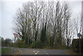
Woodland at the junction of Town Rd and Merry Boys Rd
Image: © N Chadwick
Taken: 6 Nov 2011
0.11 miles
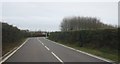
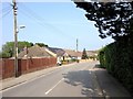
6
Buckland Road
National Cycle Route 179 towards Higham.
Image: © JThomas
Taken: 23 Jun 2022
0.19 miles
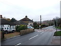
9
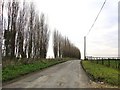
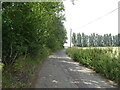
Lombardy poplars grown as a wind-break
During the 1970's and '80's many hundreds of Lombardy poplars were planted in this part of Kent, to serve as wind-breaks.
Image: © Stefan Czapski
Taken: 2 Jan 2011
0.20 miles
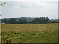
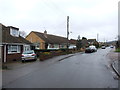
10
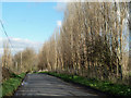
Shelter trees along Buckland Road
These are usually a sign of orchards or similar sensitive crops. In this case it appears to be former orchards.
Image: © Robin Webster
Taken: 7 Feb 2014
0.20 miles