IMAGES TAKEN NEAR TO
Upnor Road, ROCHESTER, ME2 4UZ
Introduction
This page details the photographs taken nearby to Upnor Road, ME2 4UZ by members of the Geograph project.
The Geograph project started in 2005 with the aim of publishing, organising and preserving representative images for every square kilometre of Great Britain, Ireland and the Isle of Man.

There are currently over 7.5m images from over14,400 individuals and you can help contribute to the project by visiting https://www.geograph.org.uk
Image Map
Images are licensed for reuse under creativecommons.org/licenses/by-sa/2.0
Notes
- Clicking on the map will re-center to the selected point.
- The higher the marker number, the further away the image location is from the centre of the postcode.
Image Listing (22 Images Found)
Images are licensed for reuse under creativecommons.org/licenses/by-sa/2.0
Image
Details
Distance
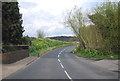
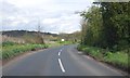
7
Berwick Way, Frindsbury
At the junction of Parsonage Lane.
Image: © Danny P Robinson
Taken: 24 Feb 2008
0.16 miles
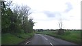
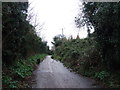
10
Oasts at Manor Farm seen from the Saxon Shore Way
This is the view from the Saxon Shore Way between Frindsbury and the crossing over the A289.
Image: © Marathon
Taken: 1 Nov 2013
0.18 miles