IMAGES TAKEN NEAR TO
Crown Wharf, Whitewall Way, ROCHESTER, ME2 4EN
Introduction
This page details the photographs taken nearby to Crown Wharf, Whitewall Way, ME2 4EN by members of the Geograph project.
The Geograph project started in 2005 with the aim of publishing, organising and preserving representative images for every square kilometre of Great Britain, Ireland and the Isle of Man.

There are currently over 7.5m images from over14,400 individuals and you can help contribute to the project by visiting https://www.geograph.org.uk
Image Map
Images are licensed for reuse under creativecommons.org/licenses/by-sa/2.0
Notes
- Clicking on the map will re-center to the selected point.
- The higher the marker number, the further away the image location is from the centre of the postcode.
Image Listing (18 Images Found)
Images are licensed for reuse under creativecommons.org/licenses/by-sa/2.0
Image
Details
Distance
1

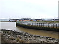
Limehouse Reach in River Medway
From Cory's Creek on Rochester Riverside walk, looking north.
Frindsbury Peninsula / Medway City Estate on other side of River.
Image: © David Anstiss
Taken: 11 Nov 2008
0.08 miles
2
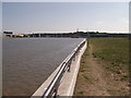
Riverwall of Limehouse Wharf
Limehouse Wharf is part of the large development land of Rochester Riverside.
On the left is the River Medway. Chatham can just be seen across the river in the middle.
Image: © David Anstiss
Taken: 1 Sep 2011
0.13 miles
3

Limehouse Reach, River Medway
Looking across the river from the Rochester side.
Image: © Des Blenkinsopp
Taken: 16 May 2019
0.15 miles
4
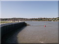
Riverwall of Limehouse Wharf
Limehouse Wharf is part of the large development land of Rochester Riverside.
On the right is the River Medway bending around Rochester.
Strood can be seen across the river in the middle.
Image: © David Anstiss
Taken: 1 Sep 2011
0.15 miles
5
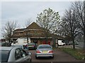
Big Breakfast Cafe
On Sir Thomas Longley Road, in the Medway City Estate.
Image: © David Anstiss
Taken: 12 Nov 2010
0.17 miles
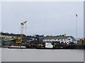

8
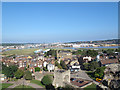
Rochester Riverside
This view from the castle gives a good overview of the strip of former industrial land alongside the Medway that has been cleared ready for residential development. See Image for a ground-level view.
Image: © Stephen Craven
Taken: 23 Sep 2013
0.20 miles
9
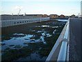
Cory's Creek, Rochester Riverside Walk
Part of new development area with Medway Council walk along River Medway.
Image: © David Anstiss
Taken: 11 Nov 2008
0.20 miles