
IMAGES TAKEN NEAR TO
Lucks Hill, WEST MALLING, ME19 6HW
Introduction
This page details the photographs taken nearby to Lucks Hill, ME19 6HW by members of the Geograph project.
The Geograph project started in 2005 with the aim of publishing, organising and preserving representative images for every square kilometre of Great Britain, Ireland and the Isle of Man.

There are currently over 7.5m images from over14,400 individuals and you can help contribute to the project by visiting https://www.geograph.org.uk
Image Map
Images are licensed for reuse under creativecommons.org/licenses/by-sa/2.0
Notes
- Clicking on the map will re-center to the selected point.
- The higher the marker number, the further away the image location is from the centre of the postcode.
Image Listing (89 Images Found)
Images are licensed for reuse under creativecommons.org/licenses/by-sa/2.0
Image
Details
Distance
1
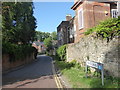
Frog Lane, West Malling
West Malling was established shortly after 1100 and today's town centre retains its medieval plan with many 17th and 18th century facades hiding much older buildings.
This view is of Frog Lane. A stream flows down the right hand side of Frog Lane under bridges to the houses. The stream has come down from the lake in Manor Park Country Park and then passed through the grounds of St Mary's Abbey before coming out at the cascade on the other side of Swan Street from here, seen at https://www.geograph.org.uk/photo/6517598
Image: © Marathon
Taken: 21 Jun 2020
0.08 miles
2
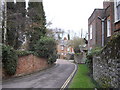
Frog Lane, West Malling
So called because lots of frogs used to come out of the stream onto the road.
Image: © PAUL FARMER
Taken: 13 Mar 2010
0.09 miles
3
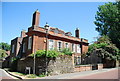
Went House, Swan St
Built in 1710, a Grade II* listed building. http://www.britishlistedbuildings.co.uk/en-392472-went-house-west-malling
Image: © N Chadwick
Taken: 10 Jul 2010
0.09 miles
4
Railway bridge over Swan Lane, West Malling
Image: © PAUL FARMER
Taken: 13 Mar 2010
0.10 miles
6
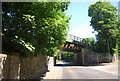
Railway bridge over Lucks Hill
The bridge carries the London to Maidstone line.
Image: © N Chadwick
Taken: 10 Jul 2010
0.10 miles
7
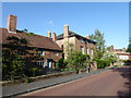
Swan Street, West Malling
West Malling was established shortly after 1100 and today's town centre retains its medieval plan with many 17th and 18th century facades hiding much older buildings. This is in Swan Street, directly opposite the cascade seen at https://www.geograph.org.uk/photo/6517598
Image: © Marathon
Taken: 21 Jun 2020
0.11 miles
8
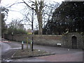
Lavenders Road West Malling
The picture is taken at the junction with Swan Street.
Image: © PAUL FARMER
Taken: 13 Mar 2010
0.11 miles
10
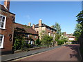
Swan Street, West Malling
West Malling was established shortly after 1100 and today's town centre retains its medieval plan with many 17th and 18th century facades hiding much older buildings. This is in Swan Street, directly opposite the cascade seen at https://www.geograph.org.uk/photo/6517598
Image: © Marathon
Taken: 21 Jun 2020
0.11 miles