IMAGES TAKEN NEAR TO
Typhoon Road, WEST MALLING, ME19 4TJ
Introduction
This page details the photographs taken nearby to Typhoon Road, ME19 4TJ by members of the Geograph project.
The Geograph project started in 2005 with the aim of publishing, organising and preserving representative images for every square kilometre of Great Britain, Ireland and the Isle of Man.

There are currently over 7.5m images from over14,400 individuals and you can help contribute to the project by visiting https://www.geograph.org.uk
Image Map
Images are licensed for reuse under creativecommons.org/licenses/by-sa/2.0
Notes
- Clicking on the map will re-center to the selected point.
- The higher the marker number, the further away the image location is from the centre of the postcode.
Image Listing (45 Images Found)
Images are licensed for reuse under creativecommons.org/licenses/by-sa/2.0
Image
Details
Distance
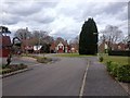
5
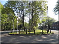
Verge between King Hill and Mosquito Road
Image: © David Howard
Taken: 8 May 2016
0.08 miles
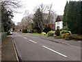
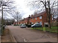
8
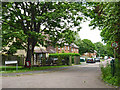
Mosquito Road
One of the roads, all named after military aircraft, of the residential quarters for the former RAF West Malling.
Image: © Robin Webster
Taken: 9 Jun 2012
0.08 miles
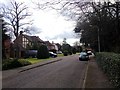
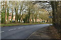
9
Hurricane Road at the junction of King Hill
Image: © David Howard
Taken: 8 May 2016
0.09 miles