IMAGES TAKEN NEAR TO
Crabtree Close, WEST MALLING, ME19 4FR
Introduction
This page details the photographs taken nearby to Crabtree Close, ME19 4FR by members of the Geograph project.
The Geograph project started in 2005 with the aim of publishing, organising and preserving representative images for every square kilometre of Great Britain, Ireland and the Isle of Man.

There are currently over 7.5m images from over14,400 individuals and you can help contribute to the project by visiting https://www.geograph.org.uk
Image Map
Images are licensed for reuse under creativecommons.org/licenses/by-sa/2.0
Notes
- Clicking on the map will re-center to the selected point.
- The higher the marker number, the further away the image location is from the centre of the postcode.
Image Listing (37 Images Found)
Images are licensed for reuse under creativecommons.org/licenses/by-sa/2.0
Image
Details
Distance
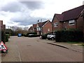
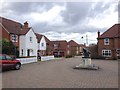
2

Worcester Avenue, Kings Hill
Kings Hill was developed from 1969 on the site of the former RAF West Malling. More detail about Kings Hill can be seen at https://en.wikipedia.org/wiki/Kings_Hill
RAF West Malling had a long and distinguished history from the First World War, through the air shows of the 1930s and the Second World War when it was a front line airfield against the Luftwaffe. After the War, West Malling was in use throughout the 1950s and early 1960s as Britain's premier night fighter station before closure as an operational air station in 1969. A fuller history of West Malling Airfield can be seen at https://en.wikipedia.org/wiki/RAF_West_Malling
Image: © Marathon
Taken: 13 Oct 2015
0.06 miles
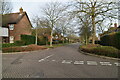
4
Worcester Avenue, Kings Hill
Kings Hill was developed from 1969 on the site of the former RAF West Malling. More detail about Kings Hill can be seen at https://en.wikipedia.org/wiki/Kings_Hill
RAF West Malling had a long and distinguished history from the First World War, through the air shows of the 1930s and the Second World War when it was a front line airfield against the Luftwaffe. After the War, West Malling was in use throughout the 1950s and early 1960s as Britain's premier night fighter station before closure as an operational air station in 1969. A fuller history of West Malling Airfield can be seen at https://en.wikipedia.org/wiki/RAF_West_Malling
Image: © Marathon
Taken: 13 Oct 2015
0.06 miles
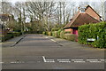
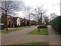
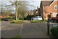
5
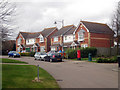
Bramley Way, Kings Hill
Houses overlooking a large oval shaped green. The centre piece of the sprawling Kings Hill development.
Image: © Oast House Archive
Taken: 26 Mar 2010
0.07 miles