IMAGES TAKEN NEAR TO
Forstal Lane, MAIDSTONE, ME17 1LB
Introduction
This page details the photographs taken nearby to Forstal Lane, ME17 1LB by members of the Geograph project.
The Geograph project started in 2005 with the aim of publishing, organising and preserving representative images for every square kilometre of Great Britain, Ireland and the Isle of Man.

There are currently over 7.5m images from over14,400 individuals and you can help contribute to the project by visiting https://www.geograph.org.uk
Image Map
Images are licensed for reuse under creativecommons.org/licenses/by-sa/2.0
Notes
- Clicking on the map will re-center to the selected point.
- The higher the marker number, the further away the image location is from the centre of the postcode.
Image Listing (13 Images Found)
Images are licensed for reuse under creativecommons.org/licenses/by-sa/2.0
Image
Details
Distance
1
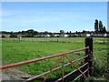
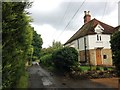
Chalet Park
Off Greenway Lane in the south of the square, looking SE.
Image: © Penny Mayes
Taken: 9 Oct 2005
0.05 miles
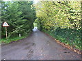
2
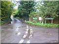
Which road is it?
Both Street View and the Ordnance Survey say that the road on the left is Greenway Lane, but the road sign says Forstal Lane. There is no confusion with the road on the right as all three call it Holm Mill Lane. This junction is just a few yards from the A20.
Image: © Marathon
Taken: 12 Nov 2013
0.09 miles
3
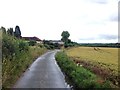
Greenway Forstal Lane, near Harrietsham
Image: © Chris Whippet
Taken: 12 Jul 2016
0.09 miles
4
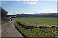
Greenway Lane
Looking South East towards Harrietsham. Edge of mobile home park to left.
Image: © Oast House Archive
Taken: 1 Mar 2010
0.11 miles
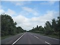
6
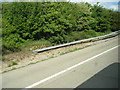
M20 start of barrier section near Waterlane Farm
Image: © Colin Pyle
Taken: 12 May 2014
0.14 miles
7
Holm Mill Lane
This view of Holm Mill Lane is taken from the junction with Greenway Lane (according to Street View and the Ordnance Survey) or the junction with Forstal Lane (according to the road sign) - see also http://www.geograph.org.uk/photo/3740732 This junction is just a few yards from the A20.
Image: © Marathon
Taken: 12 Nov 2013
0.16 miles
8
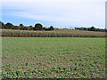
The Maidstone?Ashford line west of Harrietsham, Kent
View NE across rape and maize fields.
Image: © Rodney Burton
Taken: 28 Sep 2005
0.18 miles
10
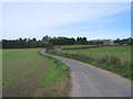
Greenway Lane, Harrietsham, Kent
View NW along the lane towards Mount Farm.
Image: © Rodney Burton
Taken: 28 Sep 2005
0.23 miles