IMAGES TAKEN NEAR TO
Dover Street, MAIDSTONE, ME16 8LE
Introduction
This page details the photographs taken nearby to Dover Street, ME16 8LE by members of the Geograph project.
The Geograph project started in 2005 with the aim of publishing, organising and preserving representative images for every square kilometre of Great Britain, Ireland and the Isle of Man.

There are currently over 7.5m images from over14,400 individuals and you can help contribute to the project by visiting https://www.geograph.org.uk
Image Map
Images are licensed for reuse under creativecommons.org/licenses/by-sa/2.0
Notes
- Clicking on the map will re-center to the selected point.
- The higher the marker number, the further away the image location is from the centre of the postcode.
Image Listing (51 Images Found)
Images are licensed for reuse under creativecommons.org/licenses/by-sa/2.0
Image
Details
Distance
1
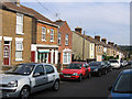
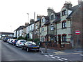
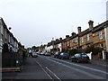
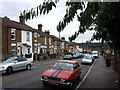
Dover Street, Maidstone, Kent
off Upper Fant Road, with houses dating from the 1890s.
Image: © Rodney Burton
Taken: 9 Sep 2006
0.02 miles
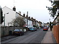


9
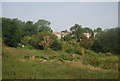
Looking towards Upper Fant Rd from the Medway Valley railway line
Image: © N Chadwick
Taken: 19 Sep 2009
0.12 miles