IMAGES TAKEN NEAR TO
Murrain Drive, MAIDSTONE, ME15 8XJ
Introduction
This page details the photographs taken nearby to Murrain Drive, ME15 8XJ by members of the Geograph project.
The Geograph project started in 2005 with the aim of publishing, organising and preserving representative images for every square kilometre of Great Britain, Ireland and the Isle of Man.

There are currently over 7.5m images from over14,400 individuals and you can help contribute to the project by visiting https://www.geograph.org.uk
Image Map
Images are licensed for reuse under creativecommons.org/licenses/by-sa/2.0
Notes
- Clicking on the map will re-center to the selected point.
- The higher the marker number, the further away the image location is from the centre of the postcode.
Image Listing (46 Images Found)
Images are licensed for reuse under creativecommons.org/licenses/by-sa/2.0
Image
Details
Distance
2
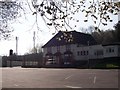
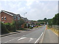
The Orchard Spot Public House, Maidstone
Pub and restaurant on access road, from Mallard Way and Deringwood Drive roundabout. In background are two mobile phone towers.
Image: © David Anstiss
Taken: 18 Mar 2009
0.11 miles
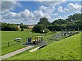
3
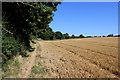
Footpath between Church Lane, Downswood and Green Hill
The path follows the high hedge at field's boundary eastwards towards Green Hill
Image: © Chris Heaton
Taken: 12 Aug 2016
0.12 miles
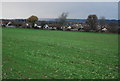
5
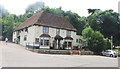
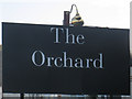
The Orchard, Bearsted
Pub off roundabout at junction of Deringwood Drive and Mallards Way.
Also see Image
Image: © Oast House Archive
Taken: 26 Nov 2010
0.12 miles
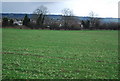
7
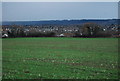
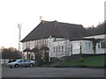
Looking towards the suburbs of Maidstone
Image: © N Chadwick
Taken: 29 Nov 2009
0.14 miles