IMAGES TAKEN NEAR TO
Mayfair Avenue, MAIDSTONE, ME15 6DS
Introduction
This page details the photographs taken nearby to Mayfair Avenue, ME15 6DS by members of the Geograph project.
The Geograph project started in 2005 with the aim of publishing, organising and preserving representative images for every square kilometre of Great Britain, Ireland and the Isle of Man.

There are currently over 7.5m images from over14,400 individuals and you can help contribute to the project by visiting https://www.geograph.org.uk
Image Map
Images are licensed for reuse under creativecommons.org/licenses/by-sa/2.0
Notes
- Clicking on the map will re-center to the selected point.
- The higher the marker number, the further away the image location is from the centre of the postcode.
Image Listing (35 Images Found)
Images are licensed for reuse under creativecommons.org/licenses/by-sa/2.0
Image
Details
Distance
1
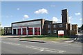
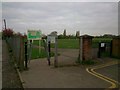
Maidstone fire station
Maidstone fire station, Loose Road, Maidstone, Kent, showing a less oblique view than Image
Image: © Kevin Hale
Taken: 17 Oct 2007
0.13 miles
3
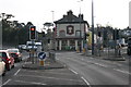
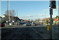
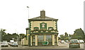
The Wheatsheaf
This public house stands at the busy junction south of Maidstone where the A229 Loose Road branches right towards Hastings and the A274 Sutton Road branches left towards Headcorn and Tenterden. Traffic lights replaced a small roundabout in the 1990s to improve traffic flow and many would say the traffic delays are worse!
Image: © Richard Sanders
Taken: 29 Nov 2005
0.16 miles
4
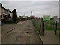
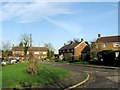
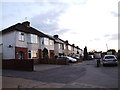
North View, Maidstone
Near the entrance to South Park.
Image: © Danny P Robinson
Taken: 10 Apr 2014
0.16 miles
7
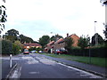
Entrance to South Park, North View, Maidstone
Image: © Danny P Robinson
Taken: 10 Apr 2014
0.19 miles
9
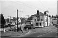
The Wheatsheaf, Loose Road, Maidstone ? 1967
Taken on the last day of trolleybus operation in Maidstone. The location is the junction between the two trolleybus routes to Park Wood (where the trolleybus is coming from) and Loose (to the right). The trolleybus is no.89, one of four purchased from the Hastings system when this closed in 1959. It is a Sunbeam W with Weymann bodywork, new in 1947.
This is one of a series of views featuring buses in the 60s, 70s, and 80s.
http://www.geograph.org.uk/search.php?i=2114547&displayclass=slide
Image: © Alan Murray-Rust
Taken: 5 Mar 1967
0.20 miles