IMAGES TAKEN NEAR TO
Newnham Court Way, MAIDSTONE, ME14 5FT

Introduction

This page details the photographs taken nearby to Newnham Court Way, ME14 5FT by members of the Geograph project.

The Geograph project started in 2005 with the aim of publishing, organising and preserving representative images for every square kilometre of Great Britain, Ireland and the Isle of Man.

There are currently over 7.5m images from over14,400 individuals and you can help contribute to the project by visiting https://www.geograph.org.uk

Image Map


Images are licensed for reuse under creativecommons.org/licenses/by-sa/2.0
Notes
  • Clicking on the map will re-center to the selected point.
  • The higher the marker number, the further away the image location is from the centre of the postcode.

Image Listing (11 Images Found)

Images are licensed for reuse under creativecommons.org/licenses/by-sa/2.0
Image
Details
Distance
1
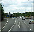
M20 Motorway, Junction 7 Slip Road For Maidstone, Heading West
Image: © Roy Hughes Taken: 28 Apr 2009
0.10 miles
2
The M20 at junction 7
Image: © Ian S Taken: 6 Jul 2014
0.11 miles
3
Exit Sliproad, M20 Junction 7
Image: © David Dixon Taken: 14 May 2013
0.14 miles
4
M20, Bridges at Junction 7
The bridges taking the A249 over the M20 at Junction 7.
Image: © David Dixon Taken: 17 May 2013
0.19 miles
5
Junction 7 overbridge, M20
Image: © N Chadwick Taken: 22 May 2015
0.20 miles
6
Southbound M20, End of Variable Speed Limit
Image: © David Dixon Taken: 15 May 2013
0.21 miles
7
M20 at Junction 7
Image: © David Dixon Taken: 17 May 2013
0.22 miles
8
Sittingbourne Road approaching Maidstone
Image: © David Howard Taken: 19 Jun 2016
0.23 miles
9
A249 northbound
The A249 is the second of two major links between the M20 and the M2 in this area. The other is the A229. Both have to ascend the North Downs (seen ahead) by rather steep hills.
Image: © Robin Webster Taken: 17 Jul 2012
0.23 miles
10
Notcutts Garden Centre
This is one of those garden centres which includes a shopping village with associated buildings so that the garden centre seems almost as an adjunct. It is on part of what was once Newnham Farm. A close up of the oast houses in the background can be seen at https://www.geograph.org.uk/photo/87475 For a map from the 1950s pre-dating the M20 and the garden centre see https://maps.nls.uk/geo/explore/#zoom=15&lat=51.2858&lon=0.5480&layers=11&b=1
Image: © Marathon Taken: 11 Oct 2018
0.24 miles