IMAGES TAKEN NEAR TO
Thurnham Lane, MAIDSTONE, ME14 4PL
Introduction
This page details the photographs taken nearby to Thurnham Lane, ME14 4PL by members of the Geograph project.
The Geograph project started in 2005 with the aim of publishing, organising and preserving representative images for every square kilometre of Great Britain, Ireland and the Isle of Man.

There are currently over 7.5m images from over14,400 individuals and you can help contribute to the project by visiting https://www.geograph.org.uk
Image Map
Images are licensed for reuse under creativecommons.org/licenses/by-sa/2.0
Notes
- Clicking on the map will re-center to the selected point.
- The higher the marker number, the further away the image location is from the centre of the postcode.
Image Listing (31 Images Found)
Images are licensed for reuse under creativecommons.org/licenses/by-sa/2.0
Image
Details
Distance
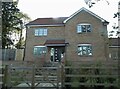
1
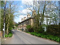
Row of cottages on Thurnham Lane
Thurnham Lane leads from Bearsted station to the village of Thurnham and eventually to Thurnham Castle on the North Downs. This terrace is shortly before Thurnham Lane passes under the M20.
Image: © Marathon
Taken: 1 Apr 2014
0.02 miles
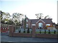
3

Derelict building seen from Thurnham Lane
Thurnham Lane leads from Bearsted station to the village of Thurnham and eventually to Thurnham Castle on the North Downs. This building is shortly before Thurnham Lane passes under the M20 and just before the terrace at http://www.geograph.org.uk/photo/3913262 It looks like it could once have been a school.
Image: © Marathon
Taken: 1 Apr 2014
0.03 miles
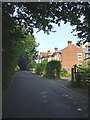
6
CTRL and M20 from Thurnham Lane
The Channel Tunnel Rail Link and M20 motorway run very close together here and cut diagonally across the square from NW to SE.
Image: © Penny Mayes
Taken: 27 Oct 2005
0.12 miles
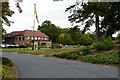
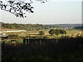
7
View from the railway line near Bearsted
Image: © N Chadwick
Taken: 28 Nov 2010
0.16 miles
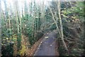
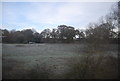
8
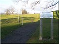
Footpath through Bearsted Golf Course
Leads to Detling and Thurnham Villages, after passing under M20 motorway.
Image: © David Anstiss
Taken: 26 Dec 2008
0.17 miles