
IMAGES TAKEN NEAR TO
London Road, FAVERSHAM, ME13 9LR
Introduction
This page details the photographs taken nearby to London Road, ME13 9LR by members of the Geograph project.
The Geograph project started in 2005 with the aim of publishing, organising and preserving representative images for every square kilometre of Great Britain, Ireland and the Isle of Man.

There are currently over 7.5m images from over14,400 individuals and you can help contribute to the project by visiting https://www.geograph.org.uk
Image Map
Images are licensed for reuse under creativecommons.org/licenses/by-sa/2.0
Notes
- Clicking on the map will re-center to the selected point.
- The higher the marker number, the further away the image location is from the centre of the postcode.
Image Listing (37 Images Found)
Images are licensed for reuse under creativecommons.org/licenses/by-sa/2.0
Image
Details
Distance
1
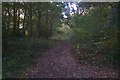
Path into Bossenden Wood
Track on Canterbury Road leading into the large wood. Popular with local dog walkers.
Image: © David Anstiss
Taken: 25 Oct 2009
0.07 miles
2
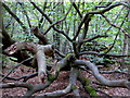
Dead tree by a path in Bossenden Wood, Dunkirk
It was in this wood in 1835 that what is thought to be the last battle on English soil took place. During a period of unrest a group of rural labourers led by John Tom, who called himself Sir William Courtenay, entered into battle with soldiers after Courtenay had murdered a local constable. A total of 11 men were killed including 8 of Courtenay's followers.
Image: © pam fray
Taken: 7 Oct 2016
0.09 miles
3
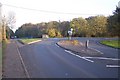
Road junction on Canterbury Road in Dunkirk
Canterbury Road from Boughton Street heads right on a bridge over the A2 Dual Carriageway to an access road to Forester's Lodge Farm (only). Also a slip road of the dual carriageway comes from the right towards Boughton Street. The Canterbury Road heads straight on to the Red Lion Pub and then onto the A2 Dual Carriageway heading to Canterbury.
Image: © David Anstiss
Taken: 25 Oct 2009
0.09 miles
4
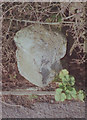
Old Milestone by London Road, Dunkirk
Stone post (plates lost) by the UC road (was A2), in parish of DUNKIRK (SWALE District), London Road, West of link road to A2, East of Prospect House, in hedge behind path, on North side of road. Dover Road facet, erected by the Chatham & Canterbury turnpike trust in the 19th century.
Inscription once read:-
: (Canterbury / 4) : : (London / 51) :
Kent HER.
HER Number: TR 05 NE 161 https://www.heritagegateway.org.uk/Gateway/Results_Single.aspx?uid=MKE77992&resourceID=1005
Milestone Society National ID: KE_LD51.
Image: © C Woodward
Taken: 23 Feb 2009
0.12 miles
9
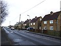
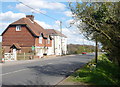
Courtenay Cottages, Courtenay Road, Dunkirk
Image: © Chris Whippet
Taken: 24 Nov 2013
0.15 miles
10
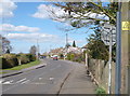
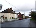
Courtenay Road, Dunkirk
Viewed from its junction with Boughton Hill. The road is named after the leader of a group of labourers who fought with soldiers from Canterbury in the Battle of Bossenden Wood, Dunkirk in 1838.
Image: © pam fray
Taken: 8 Apr 2009
0.16 miles