IMAGES TAKEN NEAR TO
Hernhill, FAVERSHAM, ME13 9JT
Introduction
This page details the photographs taken nearby to ME13 9JT by members of the Geograph project.
The Geograph project started in 2005 with the aim of publishing, organising and preserving representative images for every square kilometre of Great Britain, Ireland and the Isle of Man.

There are currently over 7.5m images from over14,400 individuals and you can help contribute to the project by visiting https://www.geograph.org.uk
Image Map
Images are licensed for reuse under creativecommons.org/licenses/by-sa/2.0
Notes
- Clicking on the map will re-center to the selected point.
- The higher the marker number, the further away the image location is from the centre of the postcode.
Image Listing (10 Images Found)
Images are licensed for reuse under creativecommons.org/licenses/by-sa/2.0
Image
Details
Distance
1
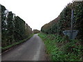
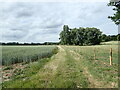
Staple Street
This is looking east past Kemsdale Lodge. The view to the left can be seen at https://www.geograph.org.uk/photo/7209683
Image: © Marathon
Taken: 25 Jun 2022
0.02 miles
2
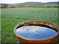
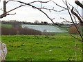
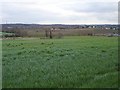
View to Hernhill and the Blean
Most of the land visible is in this square. The field looks like it may be a future hay or silage crop and it runs down to a small stream at the bottom of the valley. I've no idea why this section of pipe has been left at the edge of the field.
Hernhill Image is the settlement on the horizon left of centre while the wooded Blean, the main landmark in these parts is in the centre. Its highest point is only 108m Image but it visible for miles around.
Image: © Penny Mayes
Taken: 26 Feb 2007
0.04 miles
4
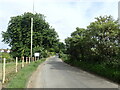
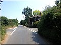
View from Staple Street
This is just west of Kemsdale Lodge. A footpath to the A299 follows the track ahead.
Image: © Marathon
Taken: 25 Jun 2022
0.07 miles
5
Strawberry field and Fairbrook Farm
Viewed across the valley from Kemsdale Road. These strawberries are growing under cloches, a common sight in this area, they look like water from a distance.
Image: © Penny Mayes
Taken: 26 Feb 2007
0.19 miles
6
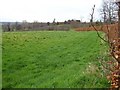
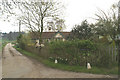
Meadow by Kemsdale Lane
Edged by a very neat beech hedge. Just visible on the left horizon is the eastern end of the Isle of Sheppey.
Image: © Penny Mayes
Taken: 26 Feb 2007
0.20 miles
8
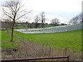
Looking south east across the valley
The pale line on the left is a small reservoir. The oasts are on Bull Lane in this square, the southern gridline runs from there to the mid right of the photo, with the sewage works in view and Boughton Street (Boughton-under-Blean) behind it in Image
Image: © Penny Mayes
Taken: 26 Feb 2007
0.23 miles
9
Strawberry field
West of Kemsdale Lane, near Kemsdale House.
Image: © Penny Mayes
Taken: 26 Feb 2007
0.24 miles