IMAGES TAKEN NEAR TO
Cheney Road, FAVERSHAM, ME13 8DG
Introduction
This page details the photographs taken nearby to Cheney Road, ME13 8DG by members of the Geograph project.
The Geograph project started in 2005 with the aim of publishing, organising and preserving representative images for every square kilometre of Great Britain, Ireland and the Isle of Man.

There are currently over 7.5m images from over14,400 individuals and you can help contribute to the project by visiting https://www.geograph.org.uk
Image Map
Images are licensed for reuse under creativecommons.org/licenses/by-sa/2.0
Notes
- Clicking on the map will re-center to the selected point.
- The higher the marker number, the further away the image location is from the centre of the postcode.
Image Listing (48 Images Found)
Images are licensed for reuse under creativecommons.org/licenses/by-sa/2.0
Image
Details
Distance
1
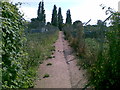
Path through allotment gardens, Faversham
Image: © Alex McGregor
Taken: 13 Jun 2011
0.06 miles
2
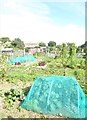
Millfield Garden Allotments, Faversham
Faversham Town Council is responsible for these thriving allotments.
Image: © pam fray
Taken: 5 Sep 2020
0.07 miles
4
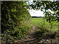
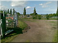
Footpath leading from Faversham to Goodnestone
Part of the Swale Heritage Trail
Image: © pam fray
Taken: 20 Oct 2011
0.08 miles
5
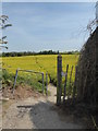
Footpath near Faversham
The path leads out of town into a rapeseed field and on to Goodnestone Court.
Image: © pam fray
Taken: 21 Apr 2020
0.09 miles
6
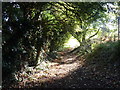
Footpath behind Abbotts Road, Faversham
Part of the Swale Heritage Trail.
Image: © pam fray
Taken: 20 Oct 2011
0.09 miles
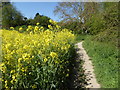
7
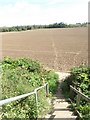
A ploughed up footpath, Faversham
North of Millfield Garden Allotments, the steps lead down to farmland which, earlier in the year, held a crop of rape with a clear footpath through it. Hopefully, when re-planted, the footpath will reappear. Luckily, the ground is very dry at present and footprints indicate direction.
Image: © pam fray
Taken: 5 Sep 2020
0.09 miles
8
Path through a rapefield, Faversham
From Whitstable Road and through Millfield allotments and farmland.
Image: © pam fray
Taken: 7 May 2020
0.09 miles
9
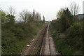
A section of the Swale Heritage Trail
Leaving the houses behind, the trail now heads towards a level crossing and, eventually, Goodnestone.
Image: © pam fray
Taken: 4 Feb 2009
0.10 miles