IMAGES TAKEN NEAR TO
Uplees Road, FAVERSHAM, ME13 0QT
Introduction
This page details the photographs taken nearby to Uplees Road, ME13 0QT by members of the Geograph project.
The Geograph project started in 2005 with the aim of publishing, organising and preserving representative images for every square kilometre of Great Britain, Ireland and the Isle of Man.

There are currently over 7.5m images from over14,400 individuals and you can help contribute to the project by visiting https://www.geograph.org.uk
Image Map
Images are licensed for reuse under creativecommons.org/licenses/by-sa/2.0
Notes
- Clicking on the map will re-center to the selected point.
- The higher the marker number, the further away the image location is from the centre of the postcode.
Image Listing (42 Images Found)
Images are licensed for reuse under creativecommons.org/licenses/by-sa/2.0
Image
Details
Distance

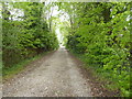
2
![A circular walk around Oare [52]](https://s3.geograph.org.uk/geophotos/07/05/52/7055207_42d67a04_120x120.jpg)
A circular walk around Oare [52]
Uplees Lodge, seen from Uplees Road.
The walk follows the long distance Saxon Shore Way along the west bank of Oare Creek to the shore of The Swale. After a left turn, the walk heads along the shoreline to Dan’s Dock. Leaving the Saxon Shore Way and moving inland, a byway and a footpath lead to Luddenham Court, from where another footpath heads back to Oare. Almost exactly 5 miles.
Image: © Michael Dibb
Taken: 5 Sep 2021
0.06 miles
3
![A circular walk around Oare [51]](https://s2.geograph.org.uk/geophotos/07/05/52/7055206_83c0023f_120x120.jpg)
A circular walk around Oare [51]
Building work alongside the track.
The walk follows the long distance Saxon Shore Way along the west bank of Oare Creek to the shore of The Swale. After a left turn, the walk heads along the shoreline to Dan’s Dock. Leaving the Saxon Shore Way and moving inland, a byway and a footpath lead to Luddenham Court, from where another footpath heads back to Oare. Almost exactly 5 miles.
Image: © Michael Dibb
Taken: 5 Sep 2021
0.06 miles
4
Uplees Road
An offshoot from the main Uplees Road that leads to a track to the Saxon Shore Way.
Image: © pam fray
Taken: 30 Apr 2020
0.07 miles
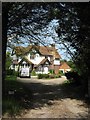
6
Jim Packman's, Uplees Road
On the no through part of the road that leads to Uplees Farm.
Image: © pam fray
Taken: 30 Apr 2020
0.08 miles
7
![A circular walk around Oare [50]](https://s1.geograph.org.uk/geophotos/07/05/52/7055205_3d471c5f_120x120.jpg)
A circular walk around Oare [50]
The track, a restricted byway, come to an end ahead where it meets Uplees Road.
The walk follows the long distance Saxon Shore Way along the west bank of Oare Creek to the shore of The Swale. After a left turn, the walk heads along the shoreline to Dan’s Dock. Leaving the Saxon Shore Way and moving inland, a byway and a footpath lead to Luddenham Court, from where another footpath heads back to Oare. Almost exactly 5 miles.
Image: © Michael Dibb
Taken: 5 Sep 2021
0.08 miles
8
![A circular walk around Oare [53]](https://s0.geograph.org.uk/geophotos/07/05/52/7055208_521a96cd_120x120.jpg)
A circular walk around Oare [53]
The footpath leaves Uplees Road and heads towards Poplar Hall.
The walk follows the long distance Saxon Shore Way along the west bank of Oare Creek to the shore of The Swale. After a left turn, the walk heads along the shoreline to Dan’s Dock. Leaving the Saxon Shore Way and moving inland, a byway and a footpath lead to Luddenham Court, from where another footpath heads back to Oare. Almost exactly 5 miles.
Image: © Michael Dibb
Taken: 5 Sep 2021
0.09 miles

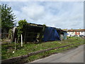
10

Frozen sheep, Uplees near Faversham
The sun can't come up soon enough for these dejected and cold looking sheep.
Image: © Matt Harrop
Taken: 23 Jan 2017
0.10 miles