
IMAGES TAKEN NEAR TO
Bell Farm Lane, SHEERNESS, ME12 4JB
Introduction
This page details the photographs taken nearby to Bell Farm Lane, ME12 4JB by members of the Geograph project.
The Geograph project started in 2005 with the aim of publishing, organising and preserving representative images for every square kilometre of Great Britain, Ireland and the Isle of Man.

There are currently over 7.5m images from over14,400 individuals and you can help contribute to the project by visiting https://www.geograph.org.uk
Image Map
Images are licensed for reuse under creativecommons.org/licenses/by-sa/2.0
Notes
- Clicking on the map will re-center to the selected point.
- The higher the marker number, the further away the image location is from the centre of the postcode.
Image Listing (8 Images Found)
Images are licensed for reuse under creativecommons.org/licenses/by-sa/2.0
Image
Details
Distance
1
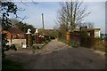
Bell Farm Lane
This lane is a footpath that runs between what appear to be Holiday Homes on the cliffs of Sheppey.
Image: © Glyn Baker
Taken: 5 Apr 2007
0.02 miles
2
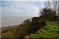
Beal?s Fall
These are the sand cliffs on the north shore of the Isle of Sheppey the view is looking towards Beal’s Fall at Paddy’s Point
Image: © Glyn Baker
Taken: 5 Apr 2007
0.15 miles
3
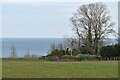
Cliff top field at East End
Walkers are urged by signs not to use the Cliff edge footpath shown on the map.
Image: © David Martin
Taken: 16 Mar 2023
0.16 miles
4
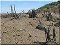
Dead trees in the beach
Because this patch of cliffside near Minster is subject to many landslides, the shrubs from the cliff tops die in the sands of the beach.
Image: © David Anstiss
Taken: 31 May 2009
0.18 miles
5
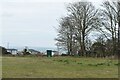
Field above holiday village at East End
With distant views over the Thames Estuary.
Image: © David Martin
Taken: 16 Mar 2023
0.23 miles
6
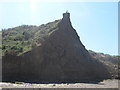
Eroded Cliff
This earthen cliff face is subject to the forces of the North Sea, this then creates many landslides and more erosion.
Image: © David Anstiss
Taken: 31 May 2009
0.23 miles
7
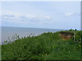
Eroded Cliffs
Picture Taken from Oak Lane
Image: © PAUL FARMER
Taken: 3 May 2009
0.23 miles
8
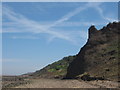
Paddy's Point
This section of the Minster cliffs are being eroded by the force of the North Sea. The cliff tops are unsafe to walk on as much of the land is subject to landslides.
Image: © David Anstiss
Taken: 31 May 2009
0.25 miles