IMAGES TAKEN NEAR TO
Warden Road, SHEERNESS, ME12 4ET
Introduction
This page details the photographs taken nearby to Warden Road, ME12 4ET by members of the Geograph project.
The Geograph project started in 2005 with the aim of publishing, organising and preserving representative images for every square kilometre of Great Britain, Ireland and the Isle of Man.

There are currently over 7.5m images from over14,400 individuals and you can help contribute to the project by visiting https://www.geograph.org.uk
Image Map
Images are licensed for reuse under creativecommons.org/licenses/by-sa/2.0
Notes
- Clicking on the map will re-center to the selected point.
- The higher the marker number, the further away the image location is from the centre of the postcode.
Image Listing (14 Images Found)
Images are licensed for reuse under creativecommons.org/licenses/by-sa/2.0
Image
Details
Distance
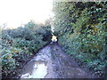
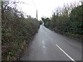
1
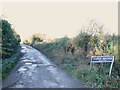
Lane leading to Swanley Farm, near Eastchurch
Image: © Chris Whippet
Taken: 23 Nov 2013
0.03 miles
3
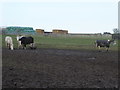
Pig and horses at Swanley Farm
There were a number of horses in the field and one pig. The pig seemed to be friends with one particular horse and was following it all around the field - see http://www.geograph.org.uk/photo/5272284 This is the view from Warden Road.
Image: © Marathon
Taken: 4 Feb 2017
0.06 miles
4
Pig and horse at Swanley Farm
There were a number of horses in the field and this one pig. The pig seemed to be friends with this particular horse and was following it all around the field. This is the view from Warden Road. See also http://www.geograph.org.uk/photo/5272286
Image: © Marathon
Taken: 4 Feb 2017
0.08 miles
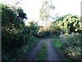
5

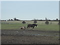
Young cattle at Swanley Farm
Looking ENE from the sharp corner in the only road in the square.
Image: © Penny Mayes
Taken: 17 Aug 2005
0.09 miles
6
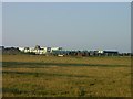
Swanley Farm - Palm Tree Holiday Park
Diversification - Caravans, silage and cattle at Swanley Farm.
Image: © Penny Mayes
Taken: 17 Aug 2005
0.09 miles
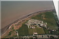
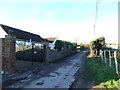
9
Warden Road
Warden Road comes to a dead end at the crumbling cliffs of Warden Point where it drops down to the beach - see http://www.geograph.org.uk/photo/5020391
Image: © Marathon
Taken: 4 Feb 2017
0.11 miles