IMAGES TAKEN NEAR TO
Wards Hill Road, SHEERNESS, ME12 2LH
Introduction
This page details the photographs taken nearby to Wards Hill Road, ME12 2LH by members of the Geograph project.
The Geograph project started in 2005 with the aim of publishing, organising and preserving representative images for every square kilometre of Great Britain, Ireland and the Isle of Man.

There are currently over 7.5m images from over14,400 individuals and you can help contribute to the project by visiting https://www.geograph.org.uk
Image Map
Images are licensed for reuse under creativecommons.org/licenses/by-sa/2.0
Notes
- Clicking on the map will re-center to the selected point.
- The higher the marker number, the further away the image location is from the centre of the postcode.
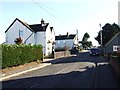
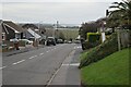
Image Listing (14 Images Found)
Images are licensed for reuse under creativecommons.org/licenses/by-sa/2.0
Image
Details
Distance
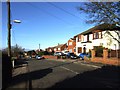
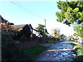
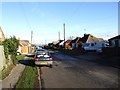
8
Wards Hill Road, with view over Minster Marshes
Image: © David Martin
Taken: 16 Mar 2023
0.16 miles
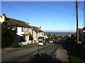
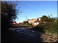
10
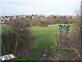
The Glen on Breakneck Hill
Small recreational ground and picnic spot on hill near Minster. Seen from close to Glenwood Drive. A new house has been built at the end of Glenwood Drive, hence sign in bushes in foreground.
Image: © David Anstiss
Taken: 24 Jan 2009
0.17 miles