IMAGES TAKEN NEAR TO
Amethyst Drive, SITTINGBOURNE, ME10 5LE
Introduction
This page details the photographs taken nearby to Amethyst Drive, ME10 5LE by members of the Geograph project.
The Geograph project started in 2005 with the aim of publishing, organising and preserving representative images for every square kilometre of Great Britain, Ireland and the Isle of Man.

There are currently over 7.5m images from over14,400 individuals and you can help contribute to the project by visiting https://www.geograph.org.uk
Image Map
Images are licensed for reuse under creativecommons.org/licenses/by-sa/2.0
Notes
- Clicking on the map will re-center to the selected point.
- The higher the marker number, the further away the image location is from the centre of the postcode.
Image Listing (40 Images Found)
Images are licensed for reuse under creativecommons.org/licenses/by-sa/2.0
Image
Details
Distance
2
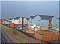
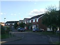
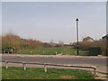
New housing development, Sittingbourne
Seen from the railway footbridge in Image this is the edge of a large development known as The Meads.
Image: © Richard Dorrell
Taken: 21 Mar 2008
0.07 miles
3
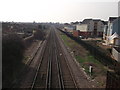
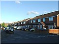
Railway to Sittingbourne
As seen from Image
This is the line from Sheerness to Sittingbourne, passing through Milton Regis.
Compare with Image, four years ago.
Image: © David Anstiss
Taken: 22 Mar 2012
0.08 miles
6
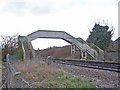
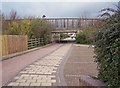
Footbridge to Laxton Way
The path from which the picture is taken now skirts a modern housing development. The bridge crosses the branch line to Sheerness.
I used to have a plastic model of a bridge exactly like this one on my model railway when I was a child!
Image: © Richard Dorrell
Taken: 21 Mar 2008
0.12 miles
8
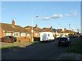
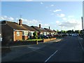
Footpath crossing Argent Way
This wide grass path leads from Emerald Crescent, through a large housing estate towards Vicarage Road.
Image: © David Anstiss
Taken: 22 Mar 2012
0.14 miles
9
Subway under Staplehurst Road
Confusingly, there are TWO Staplehurst Roads here. It's the "new" one which runs over this subway. The road and subway were built and existing roads re-aligned to create easier access to the north side of the town.
Image: © Richard Dorrell
Taken: 21 Mar 2008
0.14 miles