IMAGES TAKEN NEAR TO
Avenue Of Remembrance, SITTINGBOURNE, ME10 4NN
Introduction
This page details the photographs taken nearby to Avenue Of Remembrance, ME10 4NN by members of the Geograph project.
The Geograph project started in 2005 with the aim of publishing, organising and preserving representative images for every square kilometre of Great Britain, Ireland and the Isle of Man.

There are currently over 7.5m images from over14,400 individuals and you can help contribute to the project by visiting https://www.geograph.org.uk
Image Map
Images are licensed for reuse under creativecommons.org/licenses/by-sa/2.0
Notes
- Clicking on the map will re-center to the selected point.
- The higher the marker number, the further away the image location is from the centre of the postcode.
Image Listing (152 Images Found)
Images are licensed for reuse under creativecommons.org/licenses/by-sa/2.0
Image
Details
Distance
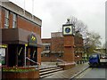
1
The Avenue Theatre, Sittingbourne
This local theatre is on the junction of Avenue of Remembrance and Central Avenue.
Image: © David Anstiss
Taken: 25 Jun 2011
0.02 miles
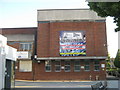
2
Phoenix House, Sittingbourne
Community Hall on Central Avenue.
Image: © David Anstiss
Taken: 25 Jun 2011
0.04 miles
3
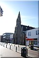
Old Town Hall clock, Sittingbourne
Erected outside Central House which was built as the new Town Hall but now forms part of the Swallows leisure centre, the council chamber having become a tiny theatre.
The plaque on the clock shows a bas relief portrait of Diana and Charles above the inscription "This clock originally sited on the former Town Hall in the High Street was restored & erected here by the people of Swale to commemorate the wedding of HRH the Prince of Wales and Lady Diana Spencer on July 29 1981.
Part of Borden Boys Grammar School may be seen in the background.
Image: © Penny Mayes
Taken: 14 Apr 2005
0.07 miles
4
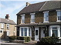
165 Park Rd
Home of Wiles family, 19th and early 20th Century
Image: © Joseph M Smith
Taken: 19 Mar 2006
0.07 miles
5
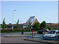
Sainsbury's, Sittingbourne
Sainsbury's moved to this new (anti-clockwise) store sited on the old Bull football ground in the 1990s. The large car park is very handy for other town centre shopping. The site of the old Sainsbury store in the Bell Shopping Centre has been empty for a year or two and very few (if any) units are now let since the upstairs of the old Hulburd's department store became a night club and the downstairs became a Wetherspoon's pub.
Image: © Penny Mayes
Taken: 27 Jun 2005
0.07 miles
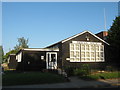
6
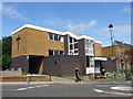
United Reformed Church Crescent Hall, Sittingbourne
Image: © Chris Whippet
Taken: 15 Aug 2013
0.07 miles
8
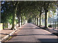
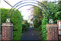
Avenue of Remembrance, Sittingbourne
This tree lined road leads towards Sittingbourne Cemetery.
On the right are the grounds of Borden Grammar School.
Image: © David Anstiss
Taken: 25 Jun 2011
0.10 miles
9
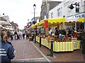
French Market, Sittingbourne
A colourful occasional event in the High Street.
Image: © Penny Mayes
Taken: 24 Sep 2005
0.11 miles