IMAGES TAKEN NEAR TO
Lower Broughton Road, SALFORD, M7 2GD
Introduction
This page details the photographs taken nearby to Lower Broughton Road, M7 2GD by members of the Geograph project.
The Geograph project started in 2005 with the aim of publishing, organising and preserving representative images for every square kilometre of Great Britain, Ireland and the Isle of Man.

There are currently over 7.5m images from over14,400 individuals and you can help contribute to the project by visiting https://www.geograph.org.uk
Image Map (27 Images)
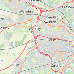

Leaflet Map data © OpenStreetMap
Images are licensed for reuse under creativecommons.org/licenses/by-sa/2.0
Notes
- Clicking on the map will re-center to the selected point.
- The higher the marker number, the further away the image location is from the centre of the postcode.
Image Listing (27 Images Found)
Images are licensed for reuse under creativecommons.org/licenses/by-sa/2.0
Image
Details
Distance
1
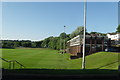
Manchester United Training Ground - The Cliff
Image: © Anthony Parkes
Taken: 24 May 2010
0.08 miles
2
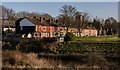
High Oldham Drive
Houses on High Oldham Drive.
Image: © Peter McDermott
Taken: 3 Jan 2020
0.14 miles
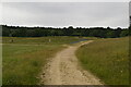
3
Three Ways In Castle Irwell
These new paths are part of the Image project that opened in February 2018
Image: © Glyn Baker
Taken: 31 Aug 2018
0.15 miles
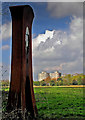
4
Eye-Glass Sculpture on the Irwell Valley Trail
Eye-Glass Sculpture on the Irwell Valley Trail, designed by - Nina Edge.
Image: © Edward Smith
Taken: 1 Jan 2009
0.16 miles
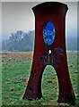
5
Eye-Glass Sculpture on the Irwell Valley Trail
Eye-Glass Sculpture on the Irwell Valley Trail, designed by - Nina Edge.
Image: © Edward Smith
Taken: 23 Apr 2008
0.16 miles
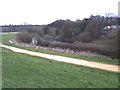
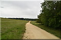
9
From the flood basin to the Beetham
Taken on the northern section of the walkway around the newly-constructed flood basin at Castle Irwell, Salford, Greater Manchester, I am looking south towards the top of Deansgate in Manchester, landmarked by the Beetham Tower.
Image: © Carroll Pierce
Taken: 6 May 2018
0.18 miles
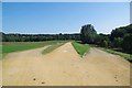
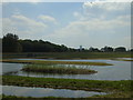
10
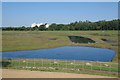
Castle Irwell Storage Basin
A small part of the Castle Irwell flood basin on the site of the former "Manchester" racecourse that closed in 1963. The Flood scheme opened in early 2018.
Image: © Glyn Baker
Taken: 31 Aug 2018
0.18 miles