IMAGES TAKEN NEAR TO
Back Duncan Street, SALFORD, M7 2EY
Introduction
This page details the photographs taken nearby to Back Duncan Street, M7 2EY by members of the Geograph project.
The Geograph project started in 2005 with the aim of publishing, organising and preserving representative images for every square kilometre of Great Britain, Ireland and the Isle of Man.

There are currently over 7.5m images from over14,400 individuals and you can help contribute to the project by visiting https://www.geograph.org.uk
Image Map (28 Images)
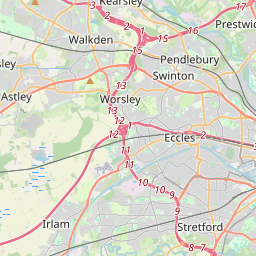
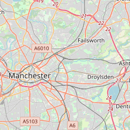

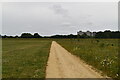
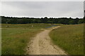
Leaflet Map data © OpenStreetMap
Images are licensed for reuse under creativecommons.org/licenses/by-sa/2.0
Notes
- Clicking on the map will re-center to the selected point.
- The higher the marker number, the further away the image location is from the centre of the postcode.
Image Listing (28 Images Found)
Images are licensed for reuse under creativecommons.org/licenses/by-sa/2.0
Image
Details
Distance
2
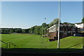
Manchester United Training Ground - The Cliff
Image: © Anthony Parkes
Taken: 24 May 2010
0.15 miles
3
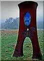
Eye-Glass Sculpture on the Irwell Valley Trail
Eye-Glass Sculpture on the Irwell Valley Trail, designed by - Nina Edge.
Image: © Edward Smith
Taken: 1 Jan 2009
0.16 miles
4
Eye-Glass Sculpture on the Irwell Valley Trail
Eye-Glass Sculpture on the Irwell Valley Trail, designed by - Nina Edge.
Image: © Edward Smith
Taken: 23 Apr 2008
0.16 miles
5
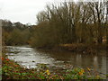
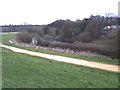
River Irwell, downriver
Taken on the Kersal Dale side in Salford, this is the River Irwell as it flows down towards Manchester city centre. The Cliff stands above the meander on the Broughton side of the river and commands a view across the Castle Irwell playing field area (currently being developed as a flood basin for Lower Broughton and Lower Kersal).
Image: © Carroll Pierce
Taken: 6 Dec 2015
0.16 miles
6
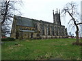
St John's Church, Broughton, Manchester
Image: © Alexander P Kapp
Taken: 6 Jan 2012
0.17 miles
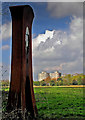
7
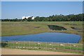
Castle Irwell Storage Basin
A small part of the Castle Irwell flood basin on the site of the former "Manchester" racecourse that closed in 1963. The Flood scheme opened in early 2018.
Image: © Glyn Baker
Taken: 31 Aug 2018
0.18 miles
8
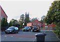
The top end of Bowker Street
The church in the background was dedicated to St John the Evangelist but was closed on 1 March 2008.
Image: © Andrew Tatlow
Taken: 2 Sep 2011
0.18 miles