IMAGES TAKEN NEAR TO
Derwent Street, SALFORD, M5 4SS

Introduction

This page details the photographs taken nearby to Derwent Street, M5 4SS by members of the Geograph project.

The Geograph project started in 2005 with the aim of publishing, organising and preserving representative images for every square kilometre of Great Britain, Ireland and the Isle of Man.

There are currently over 7.5m images from over14,400 individuals and you can help contribute to the project by visiting https://www.geograph.org.uk

Image Map


Images are licensed for reuse under creativecommons.org/licenses/by-sa/2.0
Notes
  • Clicking on the map will re-center to the selected point.
  • The higher the marker number, the further away the image location is from the centre of the postcode.

Image Listing (136 Images Found)

Images are licensed for reuse under creativecommons.org/licenses/by-sa/2.0
  • ...
Image
Details
Distance
1
McDonald's Ordsall lane Manchester
Image: © Steve Fareham Taken: 18 Nov 2009
0.04 miles
2
Regent Road approaching Ordsall Lane
Image: © Colin Pyle Taken: 21 May 2010
0.06 miles
3
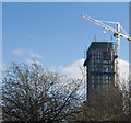
Working on a tower block
It seems to be Manchester's signature lately -tall cranes
Image: © Ian Greig Taken: 25 Nov 2016
0.07 miles
4
Gresham and Craven Factory
The Gresham and Craven site (former iron works?) on Ordsall Lane, Salford, viewed from the Woden Street footbridge.
Image: © David Dixon Taken: 1 Feb 2012
0.08 miles
5
Hulme Lock, Bridgewater Canal, Manchester
This lock dropped boats from the Bridgewater Canal to the River Irwell (and to the Manchester Ship Canal). The River Medlock enters the Irwell next to the bottom gates. The railway viaducts above carry the line from Liverpool to Manchester Oxford Road, and the Metrolink trams. This lock is now disused, a new lock at Pomona connecting the Bridgewater with Salford Quays.
Image: © S Parish Taken: Unknown
0.08 miles
6
Gresham & Craven Factory
Image: © Peter McDermott Taken: 6 Apr 2013
0.09 miles
7
Underneath the Arches
A variety of road and rail bridges cross the River Irwell here, joining the twin cities of Salford and Manchester across the boundary. A short distance downstream (behind the photographer) the Irwell becomes the Ship Canal, the makers of the Canal having taken advantage of, and widened, the course of the river in the 19th century. Ocean-going liners were enabled to berth in the nearby Pomona Docks carrying passengers all over the world.
Image: © Anthony O'Neil Taken: 21 Feb 2018
0.10 miles
8
Building Site, Woden Street
Image: © Des Blenkinsopp Taken: 30 Jun 2018
0.10 miles
9
Regent Bridge
Carrying the dual carriageway Regent Road across the River Irwell. Further upstream come four bridges in rapid succession.
Image: © Derek Harper Taken: 19 Aug 2010
0.10 miles
10
Detail of Bricklayers Arms, Ordsall Lane, Salford
Terracotta detail to this pub Image] including the date 1906.
Image: © Stephen Richards Taken: 29 May 2017
0.10 miles
  • ...