IMAGES TAKEN NEAR TO
Coniston Avenue, MANCHESTER, M45 6EG

Introduction

This page details the photographs taken nearby to Coniston Avenue, M45 6EG by members of the Geograph project.

The Geograph project started in 2005 with the aim of publishing, organising and preserving representative images for every square kilometre of Great Britain, Ireland and the Isle of Man.

There are currently over 7.5m images from over14,400 individuals and you can help contribute to the project by visiting https://www.geograph.org.uk

Image Map


Images are licensed for reuse under creativecommons.org/licenses/by-sa/2.0
Notes
  • Clicking on the map will re-center to the selected point.
  • The higher the marker number, the further away the image location is from the centre of the postcode.

Image Listing (39 Images Found)

Images are licensed for reuse under creativecommons.org/licenses/by-sa/2.0
  • ...
Image
Details
Distance
1
Rooftops through the trees
A view while a Metrolink tram was at a temporary standstill.
Image: © Bill Boaden Taken: 22 Feb 2020
0.07 miles
2
Whitefield
Industrial building on Albert Close Industrial Estate.
Image: © Peter McDermott Taken: 11 Jun 2020
0.11 miles
3
The Red King, Bury New Road
Image: © Robert Wade Taken: 24 Apr 2007
0.16 miles
4
Victoria Park and Metrolink
Victoria Park forms an enclave to the east of Bury New Road. A bridge on the Metrolink line crosses a footpath route which parallels Victoria Lane.
Image: © Jonathan Wilkins Taken: 27 Dec 2015
0.16 miles
5
Victoria Park
Image: © N Chadwick Taken: 17 Dec 2016
0.16 miles
6
Victoria Park
Image: © N Chadwick Taken: 29 Oct 2014
0.17 miles
7
Bury New Road A56
Image: © Robert Wade Taken: 24 Apr 2007
0.17 miles
8
Morrisons in Whitefield
A strategic position on the corner of Bury New Road and Church Lane.
Image: © Bill Boaden Taken: 26 Jul 2011
0.17 miles
9
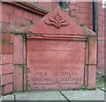
Old Milestone by the A665, Bury New Road, Bury parish
Carved stone plaque by the A665, in parish of BURY (BURY District), Bury New Road, attached to old Red King pub, No. 158-162, on East side of road. Erected by a private company in the 19th century. Inscription reads:- : To / RADCLIFFE / BRIDGE. / 1 MILE / & / 1100 YARDS / {<-arrow} : : WHITEFIELD : : To / MANCHESTER / TOWN HALL. / 5 MILES / & / 500 YARDS / {arrow->} : : TO BURY 3½ MILES. : Listed. Milestone Society National ID: LA_MABY05
Image: © Mike Faherty Taken: 26 Jan 2009
0.17 miles
10
Whitefield, milestone
Unusual terracotta milestone attached to the old Red King pub, at the junction of Bury New Road & Moss Lane. Legend reads WHITEFIELD//To/RADCLIFFE/BRIDGE./1 MILE/&/1100 YARDS/(arrow)//To/MANCHESTER/TOWN HALL./5 MILES/&/500 YARDS/(arrow)//To BURY 31/2 MILES. Presumably built with the pub, perhaps architect's whimsy.
Image: © Mike Faherty Taken: 26 Jan 2009
0.17 miles
  • ...