1
Former Failsworth Driving Test Centre
Located at 2 Partington Street M35 9RD, this driving test centre covers practical driving tests for cars, motorcycles and taxis along nearby roads. It is perhaps rather unfortunate that this DTC doesn't have a more prepossessing appearance with the window coverings being rather prominent to candidates as they arrive there to take their tests. The notice near the entrance refers to DSA (Driving Standards Agency) Safe Driving For Life. Update: this DTC closed on Friday 15th September 2017.
Image: © David Hillas
Taken: 24 Jun 2015
0.07 miles
2
Solicitors and houses on Pole Lane, Failsworth
Image: © JThomas
Taken: 10 Oct 2018
0.07 miles
3
Failsworth Pole Sign
This photo shows the sign at the South end of Main Street M35 9PD near Ashton Road West. It has the coat of arms of the former Failsworth Urban District Council which disappeared on the 1st April 1974 when it was included in the new Metropolitan Borough of Oldham.
Image: © David Hillas
Taken: 24 Jun 2015
0.08 miles
4
Pole Lane, Failsworth
Looking north west.
Image: © JThomas
Taken: 10 Oct 2018
0.10 miles
5
A view towards Ashton Road West, Failsworth
From the first floor of a Tesco supermarket in Failsworth, Greater Manchester, Ashton Road West comes in to view as the perimeter of the store's car park.
Image: © Steven Haslington
Taken: 20 Jan 2014
0.14 miles
6
Cottages on Pole Lane, near Failsworth Pole
These cottage-style houses look out on to a small public garden area in the historic heart of Failsworth. The church spire is that of St. John the Evangelist.
Image: © Linden Milner
Taken: 5 Aug 2013
0.14 miles
7
The Cotton Tree Inn, Failsworth
On Ashton Road East.
Image: © JThomas
Taken: 10 Oct 2018
0.15 miles
8
Statue of Lancashire dialect poet Ben Brierley, Failsworth
Ben Brierley (1825-1896), a renowned Lancashire dialect poet, was born in a house not far from this statue, which has been erected in a small public garden area in the historic heart of Failsworth.
Image: © Linden Milner
Taken: 5 Aug 2013
0.15 miles
9
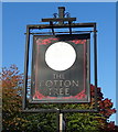
Sign for the Cotton Tree Inn, Failsworth
Image: © JThomas
Taken: 10 Oct 2018
0.16 miles
10
Ashton Road East and Roman Road diverge
Ashton Road East takes the right fork at the mini-roundabout. The left fork is Roman Road which does follow the route of a Roman road. Sharp left is Church Street which leads to St John's Church.
Image: © Bill Boaden
Taken: 2 Jun 2010
0.16 miles


