IMAGES TAKEN NEAR TO
Church Street, MANCHESTER, M35 9EZ

Introduction

This page details the photographs taken nearby to Church Street, M35 9EZ by members of the Geograph project.

The Geograph project started in 2005 with the aim of publishing, organising and preserving representative images for every square kilometre of Great Britain, Ireland and the Isle of Man.

There are currently over 7.5m images from over14,400 individuals and you can help contribute to the project by visiting https://www.geograph.org.uk

Image Map


Images are licensed for reuse under creativecommons.org/licenses/by-sa/2.0
Notes
  • Clicking on the map will re-center to the selected point.
  • The higher the marker number, the further away the image location is from the centre of the postcode.

Image Listing (72 Images Found)

Images are licensed for reuse under creativecommons.org/licenses/by-sa/2.0
  • ...
Image
Details
Distance
1
Ashton Road East and Roman Road diverge
Ashton Road East takes the right fork at the mini-roundabout. The left fork is Roman Road which does follow the route of a Roman road. Sharp left is Church Street which leads to St John's Church.
Image: © Bill Boaden Taken: 2 Jun 2010
0.03 miles
2
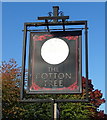
Sign for the Cotton Tree Inn, Failsworth
Image: © JThomas Taken: 10 Oct 2018
0.06 miles
3
The Cotton Tree Inn, Failsworth
On Ashton Road East.
Image: © JThomas Taken: 10 Oct 2018
0.07 miles
4
The Cotton Tree, Ashton Road East
Quite a common name for a pub round these parts.
Image: © Bill Boaden Taken: 2 Jun 2010
0.12 miles
5
St John's churchyard
The churchyard of St John the Evangelist looking towards the former Gospel Mission Image on Church Street.
Image: © Gerald England Taken: 13 Sep 2016
0.14 miles
6
Gospel Mission Hall
The Gospel Mission Hall Image on Church Street dates from 1888 and is now used by St John's as a meeting hall.
Image: © Gerald England Taken: 13 Sep 2016
0.14 miles
7
Gospel Mission Hall name stone
Name plaque on the Gospel Mission Hall Image
Image: © Gerald England Taken: 13 Sep 2016
0.14 miles
8
Pole Lane, Failsworth
Looking north west.
Image: © JThomas Taken: 10 Oct 2018
0.14 miles
9
Solicitors and houses on Pole Lane, Failsworth
Image: © JThomas Taken: 10 Oct 2018
0.14 miles
10
Parish Church of St John the Evangelist, Failsworth
St. John's was built and consecrated in 1846. The bell tower and the spire is a notable feature of Failsworth and the surrounding area. It is visible from Oldham as people travel down the A62 Oldham Road and from many parts of the parish. http://stjohnschurchfailsworth.co.uk/ church website
Image: © David Dixon Taken: 27 Jan 2011
0.14 miles
  • ...