IMAGES TAKEN NEAR TO
Water Street, MANCHESTER, M3 4AU
Introduction
This page details the photographs taken nearby to Water Street, M3 4AU by members of the Geograph project.
The Geograph project started in 2005 with the aim of publishing, organising and preserving representative images for every square kilometre of Great Britain, Ireland and the Isle of Man.

There are currently over 7.5m images from over14,400 individuals and you can help contribute to the project by visiting https://www.geograph.org.uk
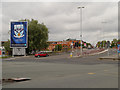
Image Map
Images are licensed for reuse under creativecommons.org/licenses/by-sa/2.0
Notes
- Clicking on the map will re-center to the selected point.
- The higher the marker number, the further away the image location is from the centre of the postcode.
Image Listing (386 Images Found)
Images are licensed for reuse under creativecommons.org/licenses/by-sa/2.0
Image
Details
Distance
1
Water Street Development
Hodder + Partners designed 307-home, 26 storey development for LQ Developments.
Image: © Peter McDermott
Taken: 28 Aug 2015
0.01 miles
2
Water Street Development
Hodder + Partners designed 307-home, 26 storey development for LQ Developments.
Image: © Peter McDermott
Taken: 4 Jul 2015
0.01 miles
3
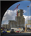
Water Street Development
The Water Street Development seen from the Mancunian Way.
Image: © Peter McDermott
Taken: 15 Oct 2016
0.01 miles
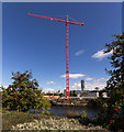
5
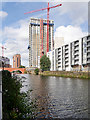
New Development next to River Irwell
New residential development (The Water Street Project http://booth-king.co.uk/wp-content/uploads/2016/01/Water-Street-Profile-Sheet.pdf ) under construction on the Manchester side of the River Irwell, near Regent Road.
Image: © David Dixon
Taken: 31 Aug 2016
0.03 miles
7
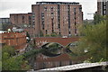
Underneath the Arches
A variety of road and rail bridges cross the River Irwell here, joining the twin cities of Salford and Manchester across the boundary. A short distance downstream (behind the photographer) the Irwell becomes the Ship Canal, the makers of the Canal having taken advantage of, and widened, the course of the river in the 19th century. Ocean-going liners were enabled to berth in the nearby Pomona Docks carrying passengers all over the world.
Image: © Anthony O'Neil
Taken: 21 Feb 2018
0.04 miles
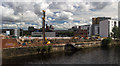
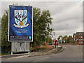
8
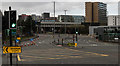
Trinity Way
Junction of Trinity Way with Regent Road.
Image: © Peter McDermott
Taken: 29 Mar 2020
0.05 miles
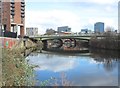
9
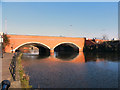
Regent Bridge
The bridge carrying Regent Road (A57) over the River Irwell, between the cities of Manchester and Salford.
Image: © David Dixon
Taken: 1 Feb 2012
0.05 miles