IMAGES TAKEN NEAR TO
Lees Avenue, MANCHESTER, M34 2BP
Introduction
This page details the photographs taken nearby to Lees Avenue, M34 2BP by members of the Geograph project.
The Geograph project started in 2005 with the aim of publishing, organising and preserving representative images for every square kilometre of Great Britain, Ireland and the Isle of Man.

There are currently over 7.5m images from over14,400 individuals and you can help contribute to the project by visiting https://www.geograph.org.uk
Image Map
Images are licensed for reuse under creativecommons.org/licenses/by-sa/2.0
Notes
- Clicking on the map will re-center to the selected point.
- The higher the marker number, the further away the image location is from the centre of the postcode.
Image Listing (84 Images Found)
Images are licensed for reuse under creativecommons.org/licenses/by-sa/2.0
Image
Details
Distance
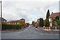
1
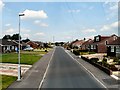
Ruby Street
A street containing a lot of modern bungalows.
Image: © Gerald England
Taken: 27 Jun 2011
0.06 miles
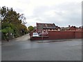
2
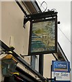
Sign for Acres Inn (South face)
Image: © Gerald England
Taken: 5 Oct 2015
0.16 miles
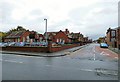
3
Acre Street
From the corner of Duke Street.
Image: © Gerald England
Taken: 5 Dec 2011
0.16 miles
4
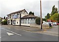
Acres Inn
Image: © Gerald England
Taken: 5 Oct 2015
0.16 miles
5
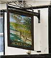
Sign for Acres Inn (North face)
Image: © Gerald England
Taken: 5 Oct 2015
0.16 miles
7
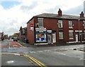
Acre Street Mini Market
Off licence on the corner of Acre Street and Duke Street.
Image: © Gerald England
Taken: 12 May 2014
0.17 miles
8
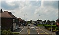
Town Lane
Approaching Circular Road.
Image: © Gerald England
Taken: 27 Jun 2011
0.17 miles
9
Denton Central Primary School
Originally known as Denton Council School, the buildings on Duke Street were converted to a military hospital during the First World War. During the Second World War it was used as a first aid station, run by the St John Ambulance Brigade.
It is now Dental Central Primary School and ASD Resource Base Image, Manchester. The main entrance is on Acre Street. Another part of the school was used as a Young People's Centre Image but that is now closed and for sale.
Image: © Gerald England
Taken: 5 Oct 2015
0.19 miles
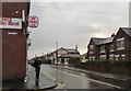
10
Duke Street
On the left is what was Denton Council School. The buildings were converted to a military hospital during the First World War. During the Second World War it was used as a first aid station, run by the St John Ambulance Brigade.
It is now Dental Central Primary School and ASD Resource Base, Manchester Image The main entrance is on Acre Street. A separate part of the school further down Duke Street was used as a Young People's Centre Image but that is now closed and for sale.
Image: © Gerald England
Taken: 5 Oct 2015
0.19 miles