IMAGES TAKEN NEAR TO
Mossfield Green, MANCHESTER, M30 7RZ
Introduction
This page details the photographs taken nearby to Mossfield Green, M30 7RZ by members of the Geograph project.
The Geograph project started in 2005 with the aim of publishing, organising and preserving representative images for every square kilometre of Great Britain, Ireland and the Isle of Man.

There are currently over 7.5m images from over14,400 individuals and you can help contribute to the project by visiting https://www.geograph.org.uk
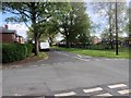
Image Map
Images are licensed for reuse under creativecommons.org/licenses/by-sa/2.0
Notes
- Clicking on the map will re-center to the selected point.
- The higher the marker number, the further away the image location is from the centre of the postcode.
Image Listing (10 Images Found)
Images are licensed for reuse under creativecommons.org/licenses/by-sa/2.0
Image
Details
Distance
2
The premises of Hydrainer Pump Hire
On the A57 on the north bank of the Manchester Ship Canal.
Image: © Christine Johnstone
Taken: 13 Apr 2013
0.10 miles
3
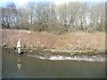
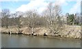
Stakes reinforcing the Manchester Ship Canal's banks
One of several ways of dealing with the erosion caused by passing ships.
Image: © Christine Johnstone
Taken: 13 Apr 2013
0.11 miles
4
Manchester Ship Canal beacon 374
On the north bank, at the north end of Irlam.
Image: © Christine Johnstone
Taken: 13 Apr 2013
0.13 miles
5
Manchester Ship Canal beacon
On the north bank, alongside Cadishead Way.
Image: © Christine Johnstone
Taken: 13 Apr 2013
0.16 miles
6
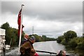
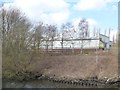
On the Manchester Ship Canal
Looking from the stern of a Mersey ferry heading south on the canal having passed under the power lines seen here.
Image: © Trevor Harris
Taken: 2 Sep 2012
0.16 miles
8
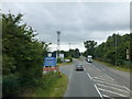
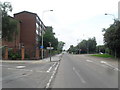
Liverpool Road at Boysnope
Telecommunications mast seen on left
Image: © Raymond Knapman
Taken: 5 Aug 2014
0.21 miles
10
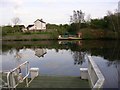
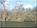
Hulme's Bridge Ferry.
This ferry is on the Manchester Ship Canal and connects Irlam, on the north bank, with Flixton to the south. It is still operational and is a free ferry. It replaced a bridge crossing the River Irwell, which was canalised during the construction of the canal in the 1890s. I believe it still operates because an Act of Parliament requires it. Taken from SJ737958.
Image: © Keith Williamson
Taken: 13 Apr 2005
0.24 miles