IMAGES TAKEN NEAR TO
The Warke, MANCHESTER, M28 2WX

Introduction

This page details the photographs taken nearby to The Warke, M28 2WX by members of the Geograph project.

The Geograph project started in 2005 with the aim of publishing, organising and preserving representative images for every square kilometre of Great Britain, Ireland and the Isle of Man.

There are currently over 7.5m images from over14,400 individuals and you can help contribute to the project by visiting https://www.geograph.org.uk

Image Map


Images are licensed for reuse under creativecommons.org/licenses/by-sa/2.0
Notes
  • Clicking on the map will re-center to the selected point.
  • The higher the marker number, the further away the image location is from the centre of the postcode.

Image Listing (15 Images Found)

Images are licensed for reuse under creativecommons.org/licenses/by-sa/2.0
Image
Details
Distance
1
A575 at Worsley Park Hotel
Image: © Colin Pyle Taken: 3 Oct 2015
0.12 miles
2
St Mark's - Worsley
The spire of St. Marks church in Worsley in autumn 2004.
Image: © Gary Rogers Taken: 26 Oct 2004
0.14 miles
3
Worsley, St Mark
Image: © Dave Kelly Taken: 11 Mar 2016
0.15 miles
4
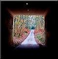
Under the M60
Image: © Anthony Parkes Taken: 29 Nov 2022
0.17 miles
5
Manchester : Salford - The M60
The M60 heading out of Manchester and north via Salford.
Image: © Lewis Clarke Taken: 11 Oct 2014
0.18 miles
6
Worsley : M60 Motorway
The M60 motorway between Junction 15 (Worsley Braided Interchange) and Junction 14.
Image: © Lewis Clarke Taken: 27 Sep 2019
0.20 miles
7
The John Gilbert Pub, Worsley
Worsley Brow, Worsley MANCHESTER M28 2YA near to The Bridgewater Canal Leigh Branch
Image: © canalandriversidepubs co uk Taken: 9 Apr 2010
0.20 miles
8
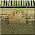
Old Boundary Marker on Old Hall Lane, Worsley
Boundary Marker in the entrance to Lady Hill House on the south side of Old Hall Lane 20 metres west of the junction with the A575 Walkden Road. In the former Worsley parish. Recorded as one of five place name stones around Worsley in a document of City Boundary Stones. There is no evidence of Ladyhill being a township or parish. Greater Manchester Historic Environment Record says it is a Plague Stone. It may just be the name of the house and doesn’t look very old. Milestone Society National ID: LA_LADH01bm
Image: © C Leather Taken: 17 Aug 2024
0.21 miles
9
Worsley : M60 Motorway
The M60 motorway between Junction 15 (Worsley Braided Interchange) and Junction 14.
Image: © Lewis Clarke Taken: 27 Sep 2019
0.21 miles
10
Old School House, Worsley
Image: © Gary Rogers Taken: 11 Oct 2009
0.22 miles